

Explore the history, culture, people and beautiful landscapes of Vietnam on the 63Stravel travel app
Download the 63stravel app

The exhibition house is a place to introduce valuable information, documents, and images about the process of establishing and protecting sovereignty over the Hoang Sa archipelago of Vietnam.
Hoang Sa Exhibition House is located on Hoang Sa Street (Son Tra District, Da Nang City), inaugurated in March 2018. The project faces the East Sea, has a ground floor, three floating floors, and a construction height of 18m.
This is a place to display hundreds of documents, artifacts, maps, images... reflecting the historical process of establishing Vietnam's sovereignty over the Hoang Sa archipelago (now part of Hoang Sa district, Da Nang city).
The documents are divided into 5 topics, throughout the history of the formation process, geographical location, and sovereignty of Hoang Sa on legal documents and maps circulated domestically and internationally.
Hoang Sa Exhibition House is a "red address" for people, tourists, especially the younger generation, to study, research, and feel about a sacred part of the Fatherland's territory.
To date, this location has welcomed hundreds of thousands of people and tourists to visit. In just the 10 months of 2023 (the first two months of the year were closed for repairs), the exhibition house welcomed more than 21,000 visitors.
Pictures of Hoang Sa exhibition house:
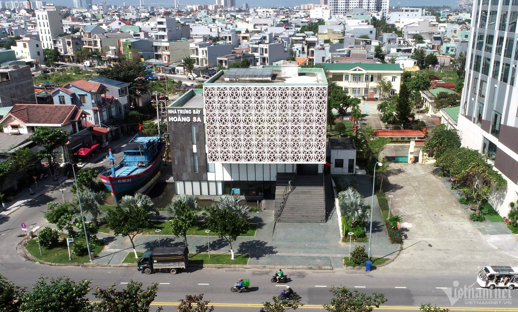 Nhà trưng bày Hoàng Sa nằm trên đường Hoàng Sa (TP Đà Nẵng), được lấy cảm hứng từ hình tượng con dấu của vua Minh Mạng trong Sắc chỉ thành lập Hải đội Hoàng Sa năm 1835. Đây là nhà trưng bày về chủ quyền quần đảo Hoàng Sa đầu tiên ở Việt Nam.
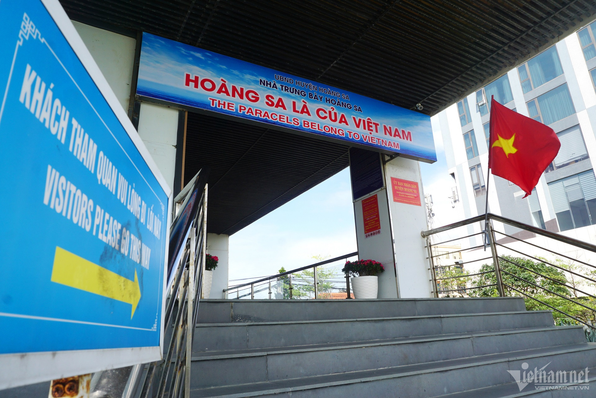 Nhà trưng bày là nơi tuyên truyền, khẳng định chủ quyền của Việt Nam đối với hai quần đảo Hoàng Sa, Trường Sa.
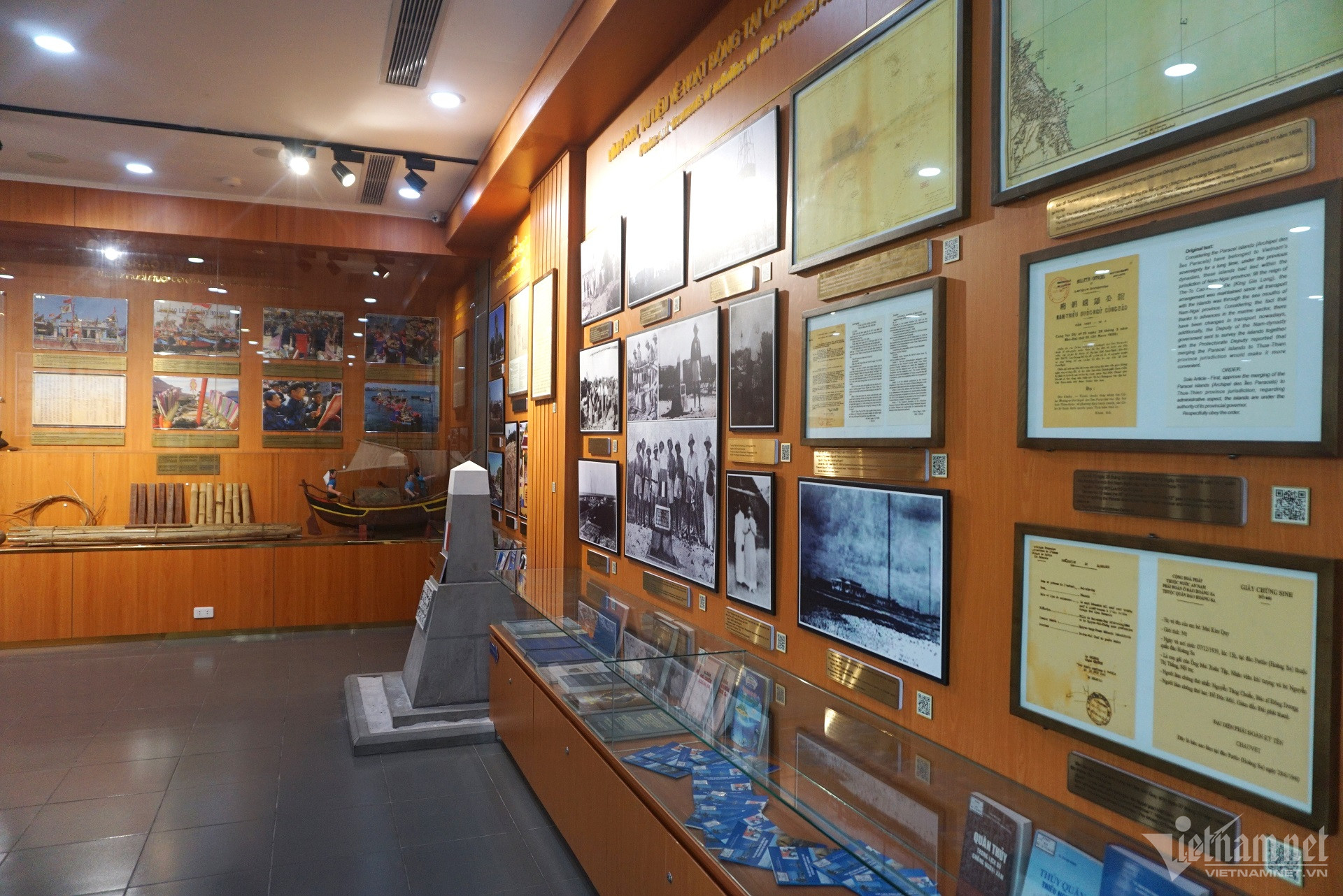 Nơi đây có hơn 300 tư liệu và hiện vật. Tại các điểm trưng bày có nhiều màn hình trình chiếu hình ảnh tư liệu về quá trình xác lập chủ quyền, quản lý hành chính liên tục của Việt Nam từ thời nhà Nguyễn đến sau này.
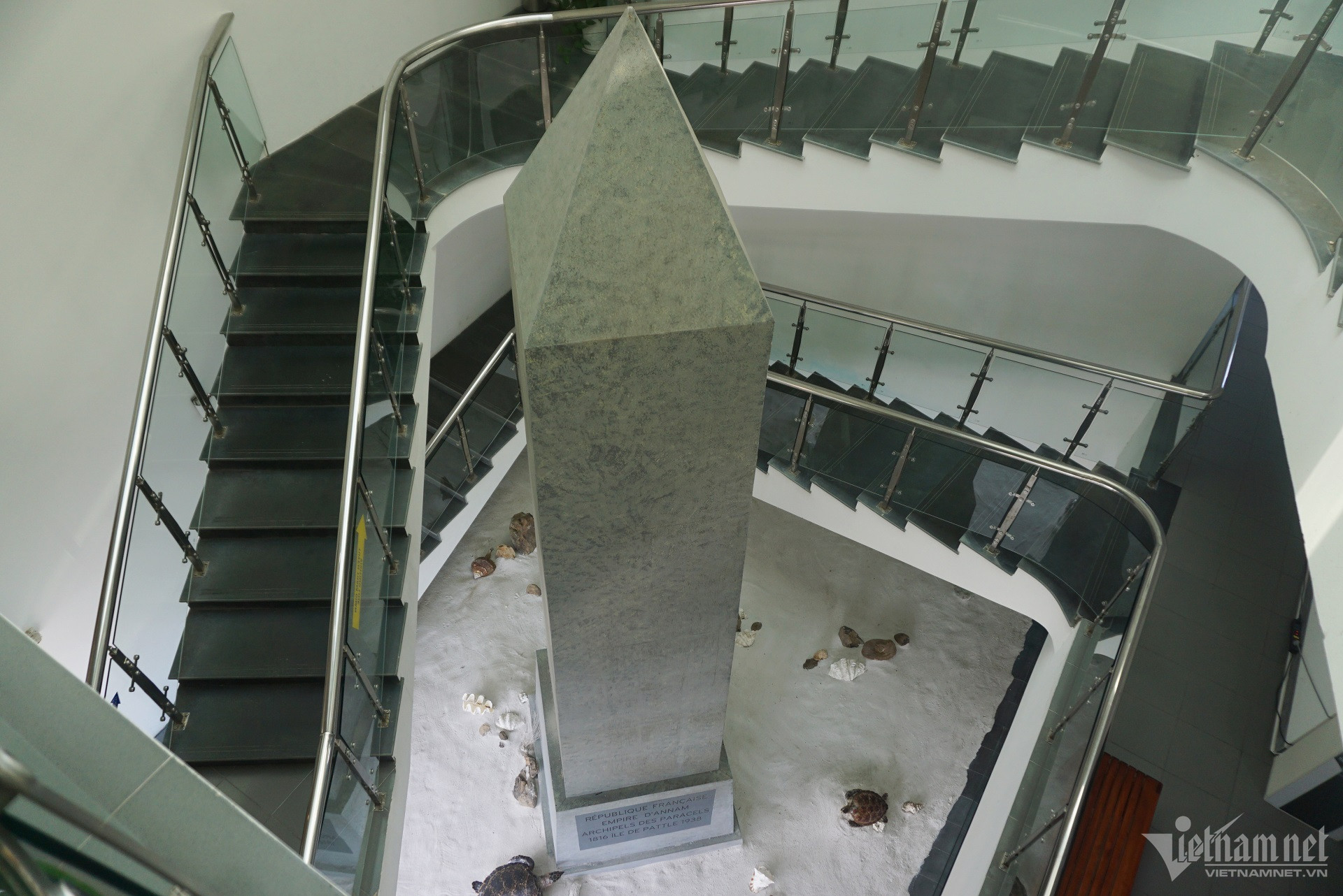 Cột mốc chủ quyền Hoàng Sa được tái hiện ở khu vực trung tâm nhà trưng bày.
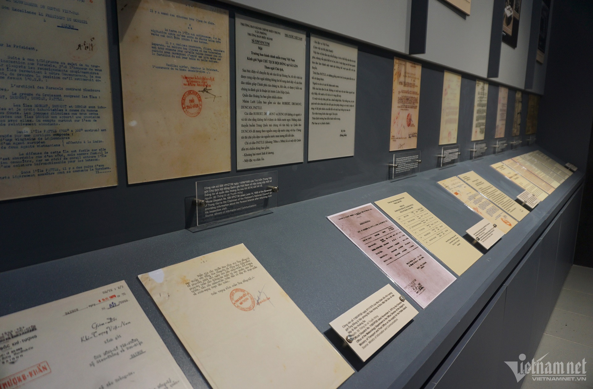
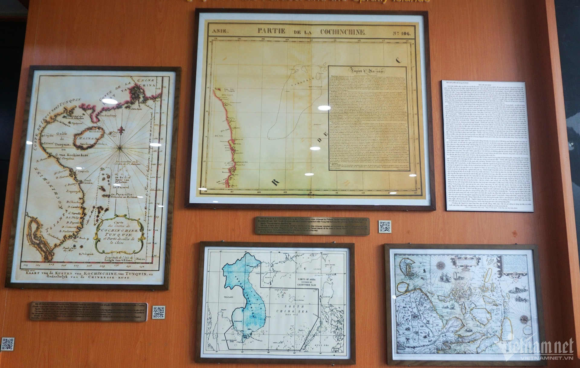

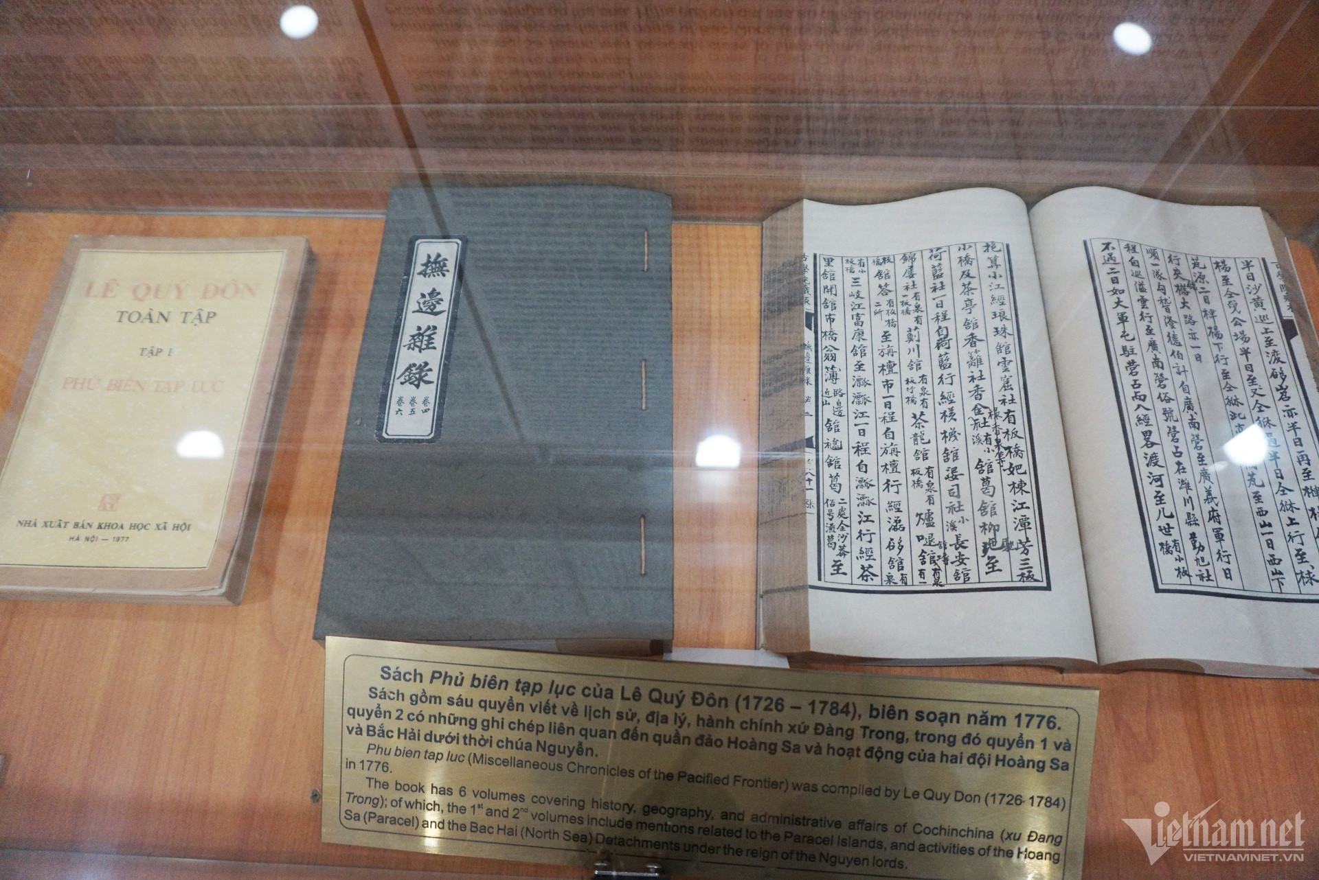
The documents are divided into 5 topics, throughout the history of the formation process, geographical location, and sovereignty of Hoang Sa on legal documents and maps circulated domestically and internationally.
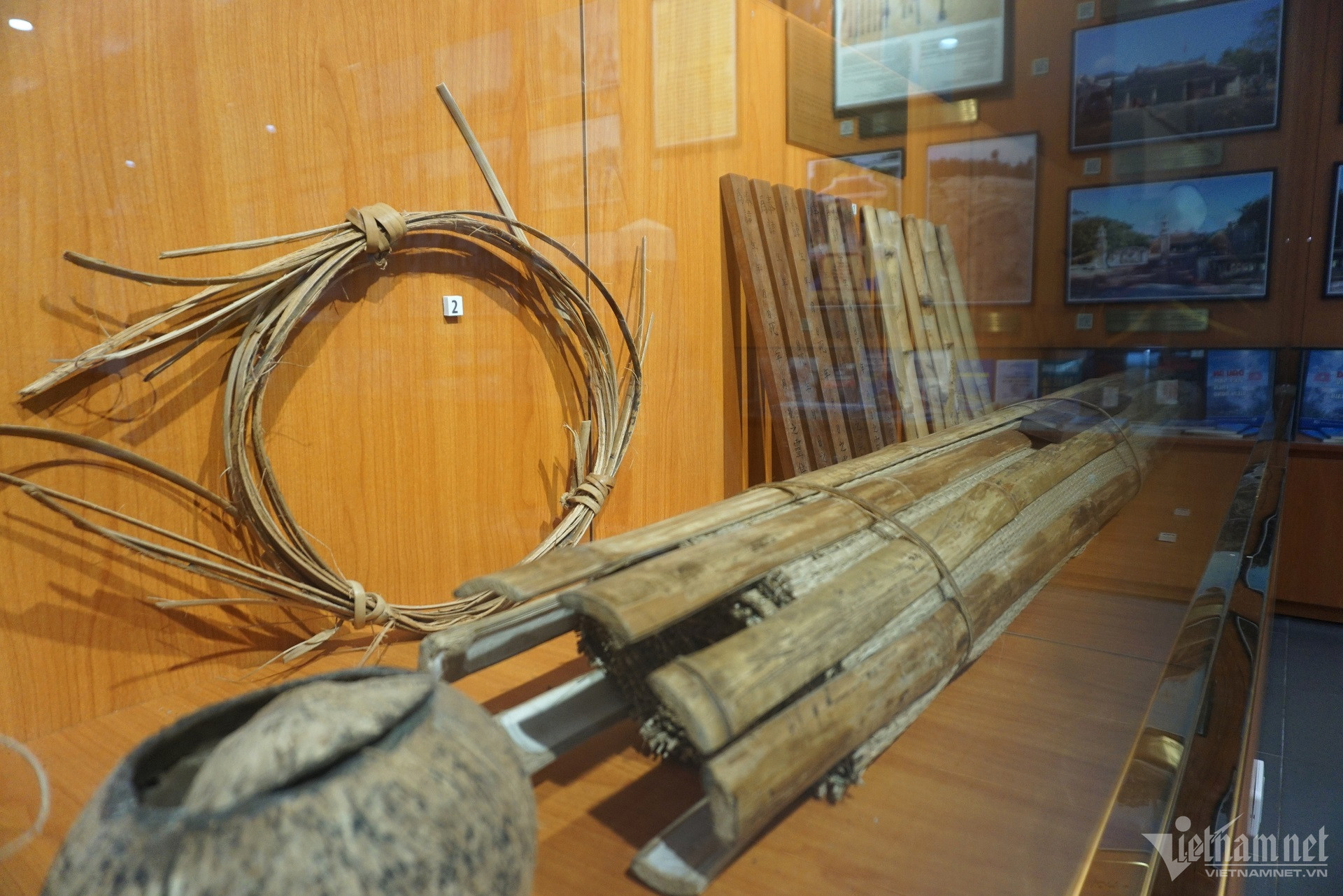
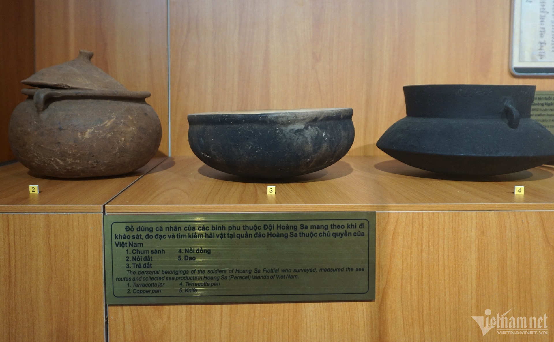
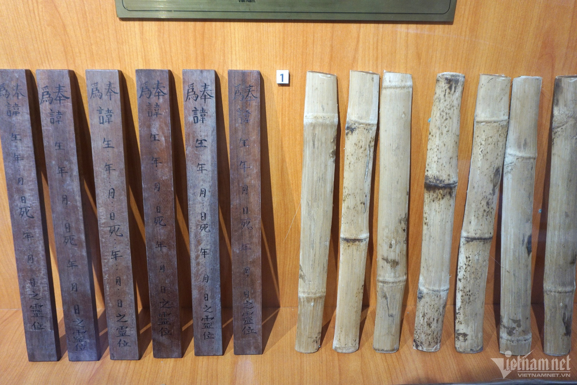
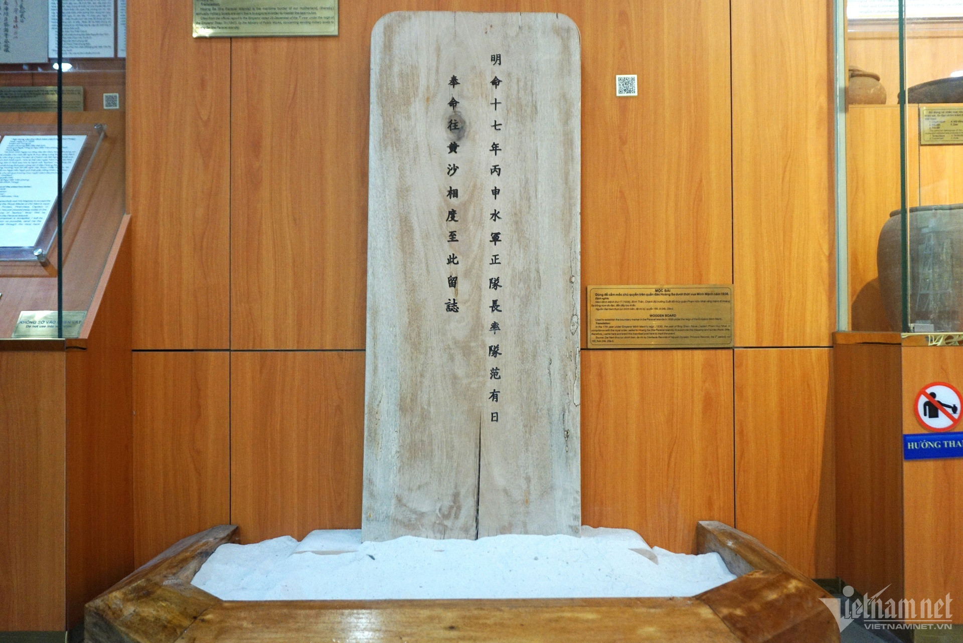
In recent years, the People's Committee of Hoang Sa district has launched many campaigns to collect and contribute documents and artifacts about Hoang Sa, such as maps of Vietnamese dynasties through historical periods that consistently affirm the theme of Hoang Sa. Vietnam's rights over the Hoang Sa archipelago.
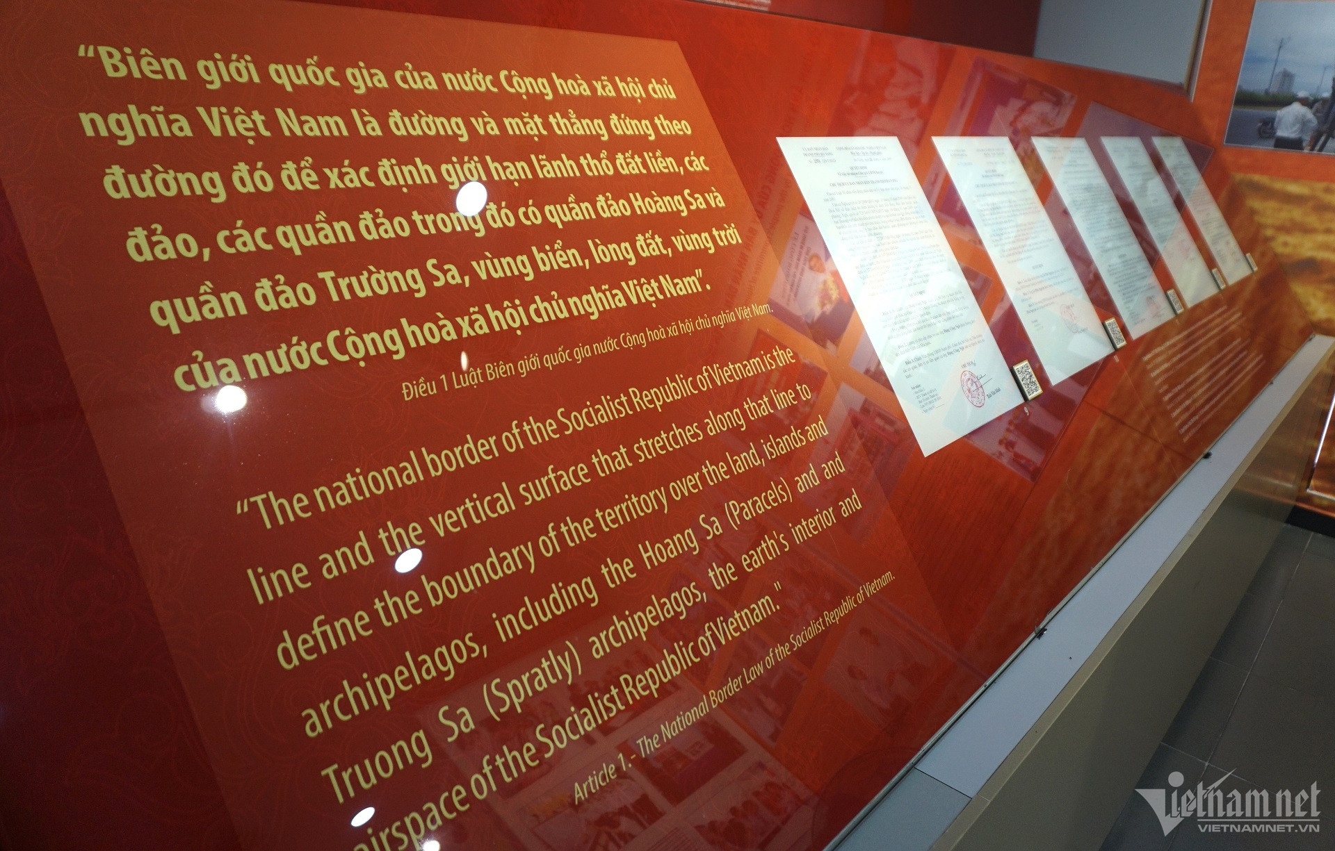
The exhibitor also quoted Article 1 of the National Border Law of the Socialist Republic of Vietnam, affirming Vietnam's territorial sovereignty including the two archipelagos of Hoang Sa and Truong Sa.
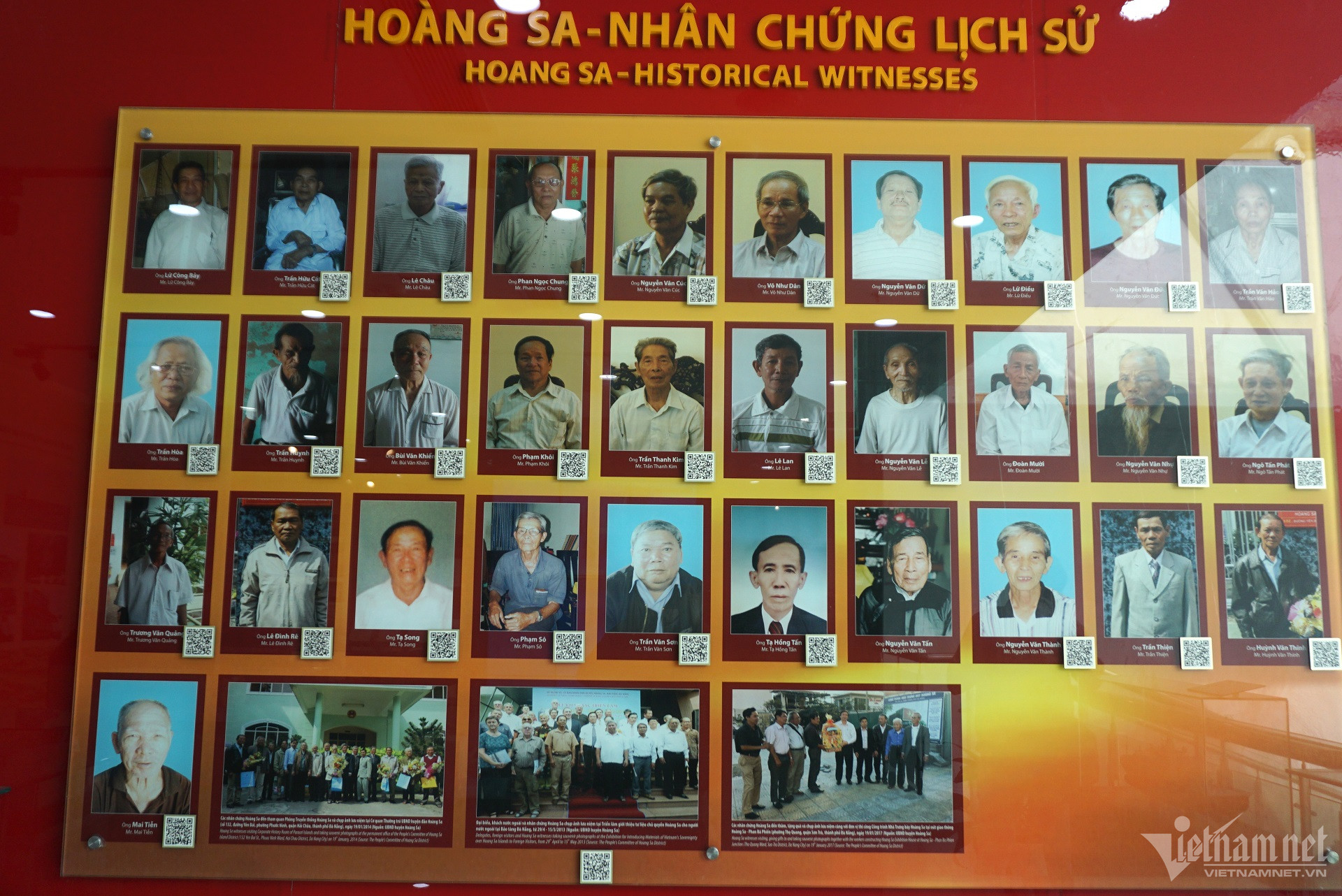
Images of Hoang Sa witnesses are given a solemn corner in the exhibition house. These are the people who went directly to Hoang Sa to perform the task of protecting and measuring meteorology...
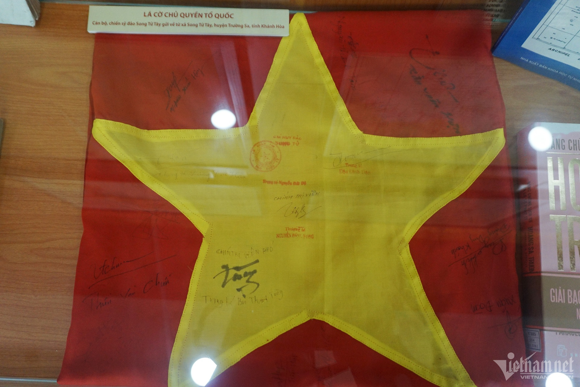
Each photo, map, artifact... displayed at the Hoang Sa Exhibition House has precious historical and legal value, and is indisputable evidence of Vietnam's sovereignty over the islands. the two archipelagos Hoang Sa and Truong Sa.

Hoang Sa Exhibition House is a "red address" for people, tourists, especially the younger generation, to study, research, and feel about a sacred part of the Fatherland's territory.

Students participate in a practical learning program at Hoang Sa Exhibition House. Children have visual access to documents, images, and artifacts, from which they better understand the process of establishing, enforcing, and protecting Vietnam's sovereignty over the Hoang Sa archipelago through historical periods. .
The Hoang Sa archipelago is one of two offshore archipelagos under Vietnam's sovereignty for a long time. Historically, the Hoang Sa archipelago was also called "Bai Cat Vang", the international name often shown on nautical charts is Paracels.
The archipelago consists of over 37 islands, rocks, shoals, and reefs, located in the northern region of the East Sea, from about 15o45' to 17o15' North latitude, 111o to 113o East longitude, in a sea area of about 16,000km2 off the coast of Ho Chi Minh City. Da Nang 170 nautical miles (315km). The entire surface area of the archipelago is about 10km2, of which Phu Lam island is the largest with about 1.5km2.
Da Nang 2441 view
Update day : 15/02/2024
Da Nang has transformed itself into an interesting tourist and resort destination, no longer the barren Central region as before. Explore and enjoy unique experiences at the tourist destination Da Nang - Ba Na Hills. The shopping area at the tourist destination Da Nang - Ba Na Hills has up to 20 souvenir shops, offering more than 2,000 diverse products. They are distributed throughout the tourist area, from the train station, wax statue display area, to Doumer restaurant and Fantasy Park... Here, you can easily find unique and meaningful souvenirs to give to your loved ones such as gemstone paintings, sand paintings, pebble paintings, embroidery paintings, lacquer paintings, scroll paintings, origami paper folding. , hand-painted dresses... In addition, you can also choose high-end gifts such as 3D statue carvings, cosmetic lines, high-end essential oils produced specifically for Ba Na... Especially at French Village, there is a shopping area with a full range of high-end goods from fashion, cosmetics, jewelry, and branded handbags. After experiencing Da Nang destinations at Fantasy Park or Love Flower Garden, visit the luxurious European cuisine area to enjoy unique delicacies. You can enjoy fast food and grilled food from famous restaurants such as Morin, Kavkaz, Buffet Club, La Crique&Café Postal, KavKaz Vista... Du Dôme Square is located atop the Medieval Castle in Fantasy Park, with creative architecture and panoramic views of Ba Na Mountain. Four tall columns and classic colors at this culinary square take you back to the Middle Ages. To fully experience the beauty of Ba Na overnight, you can stay at 3-star or 4-star hotels. These locations provide luxurious spaces, comfortable rooms and many good services. The 3-star Morin Hotel and the 4-star French Village offer distinct architecture but common luxury in a classic, elegant French style. The interior is meticulously decorated, with beautiful views and fireplaces in each room, ensuring coziness on cold winter nights. Shopping, enjoying cuisine and experiencing relaxation are three great experiences to explore the majestic beauty of Ba Na mountain.
Da Nang 1943 view
From January to December
The Golden Bridge with the support of giant hands is being shared rapidly on social networking sites and travel communities, making many people surprised. Golden Bridge, a new project of Sun World Ba Na Hills. Construction started in July 2017 and was completed in April 2018. It recently went into operation and welcomed the first visitors to Da Nang. Possessing an extremely unique and novel design, unprecedented in Vietnam, the bridge was built at an altitude of more than 1,400 meters above sea level, with a total length of about 150 meters, with 8 bridge spans. The largest is 21.2 meters. The bridge's surface is made of wood, 3 meters wide and 5 cm thick. Along both sides of the walkway are planted many Green Queen flowers, above is a railing made of gold-plated stainless steel. It can be seen that this bridge is designed and shaped to resemble the image of a woman using her hands to support a golden silk strip across. With its unique image, the Golden Bridge in Ba Na Hills has made many people surprised and admired the creativity of the designers and builders of this project. Not only can you admire the beauty of this unique project, coming here you will also be able to freely admire the majestic and breathtaking beauty of the surrounding mountains and forests. The feeling of walking above the floating clouds, admiring the beautiful scenery below will be an extremely wonderful experience for many visitors. Many beautiful photos have been taken by tourists here, many viewers thought this was some foreign tourist destination. But when they learned that it was the Golden Bridge on top of Ba Na, everyone was extremely surprised and excited and wanted to come immediately to admire this beautiful scene. It can be seen that Da Nang not only possesses amazing natural landscapes, but also works built from the human mind and hands are also presented in this city in an extremely unique way, including not It is impossible not to mention the Golden Bridge in Da Nang, a highly artistic work.
Da Nang 2427 view
March to August
Ngu Hanh Son Mountain - an impressive tourist destination in Da Nang, also known by the people here as Non Nuoc Mountain, is formed by a complex of five limestone mountains according to Metal - Wood - Water - Fire - Earth with many The legendary story still resonates today. The name Non Nuoc mountain has been around for a long time and is included in local people's songs: "In the afternoon, clouds cover Son Tra, Thunder rumbles in Non Nuoc, the sky turns to rain". Visitors coming here will be amazed by the majestic and magical natural scenery that the Creator has bestowed on this place. Ngu Hanh Son is located on a vast, vast white sand beach near the coast stretching from Cat Tien Sa peninsula to Non Nuoc beach, in Hoa Khue village, Son Thuy hamlet, Hoa Vang district, now Hoa Hai ward, Ngu district. Hanh Son, less than 8 km drive southeast from Da Nang city center. Ngu Hanh Son is famous throughout the country for the unique beauty of a sky, sea, and water with long-standing profound historical, cultural, and spiritual values. Walking on the mountains of Ngu Hanh Son, visitors can freely pick up beautiful marbles. The interesting thing here is that each mountain has a different color of stone, like the blue stone in Kim Son. The sea water is quiet, the rocks in Tho Son are brown, the rocks in Moc Son are pure white, the rocks in Thuy Son are pink and the rocks in Hoa Son are bright red, each type of rock has a corresponding color. with the five elements in Oriental feng shui and perhaps the names of those five mountains were also named for that reason. Ngu Hanh Son is not only diverse in gemstones but also has many rare and valuable herbs such as: Thien Tue, Canh Thien, Moc Tinh, Truong Sinh Agar, Cung Nhan Thao, and Ly Ly. Coming to Ngu Hanh Son - one of the tourist destinations in Da Nang, visitors can also improve their knowledge about many diverse animal species such as bats, sea birds, monkeys,... walking slowly and breathing. What could be better than enjoying the fresh, airy atmosphere and seeing many colorful and fragrant wild flowers, most of which are wild orchids? That land of Ngu Hanh Son is not only legendary, not only five elements, spiritual, not only a land of natural talent, spiritual land but also a piece of history, associated with people and names that have passed away. go into history books. Tourists will visit the grave of General Tran Quang Dieu's mother and the temple of Princess Ngoc Lan - King Minh Mang's younger sister, or visit the poetic autographs of the Le and Tran dynasties printed on the covered cliffs. Moss and moss follow the flow of time, all creating an eloquent testament to a legendary Marble Mountains, a land of spiritual masterpieces. Walking along the trails, tourists who are passionate about exploration will have the opportunity to visit the unique and amazing cave system, which is one of a kind beauty here. To explore and admire all the main caves of Marble Mountains, visitors will have to invest 2 to 4 days with a tight schedule such as visiting Quan Am cave of Kim Son, Huyen Vi cave of Hoa Son or Am cave. Phu, Linh Nha, Huyen Khong, Van Thong, Thien Long, Thien Phuoc Dia of Thuy Son, visitors will experience many different levels of emotions when going to those caves. According to many tourists, the most outstanding of all are Am Phu cave, Huyen Khong cave and Van Thong cave. Am Phu Cave of Kim Son Mountain with many legends both real and virtual, has long been spread everywhere, inherently all things always exist in two opposing directions: day must have night, when people are born, there must be If there is a heaven, there must be a hell because the cave has two entrances to heaven and to hell. The cave was named that way during the reign of King Minh Mang in the early 19th century, when the king visited this mountain. The underworld is understood as the world of the dead, but according to Buddhism, death is not the end but a transition to reincarnation to another realm. Good and evil will be clearly defined in black and white. Huyen Khong Cave at a tourist destination in Da Nang is an open-air cave with a flat floor, a circular dome with 5 ventilation holes to the outside. On sunny days, the cave glows with natural light pouring in, creating an atmosphere. shimmering mysterious space. At the top, there is a statue of Shakyamuni Buddha, below is the altar of Ksitigarbha Bodhisattva, on the left is the altar of Lady Fairy, where tourists from business and trade come to pray for wealth and fortune. The temple to worship Lady Thuong Ngan is where most tourists come to pray for health and peace. Around the dome of the cave, there are many rocks clinging to the walls, creating strange shapes such as: the face of an old man, the image of a crane, an ostrich, the image of two elephant heads with trunks hanging down to the ground, the image of a stork with a Long sharp beak pressed against the cave wall... Van Thong Cave is nestled in the heart of the mountain, with a circular pipe slanting up towards the mountain. In the cave, there is a stone stele with three ancient words "Ngu Uan Son", in the middle of the cave there is a very large Buddha statue, behind is a road. Going up to the cave, the deeper you go, the narrower it gets and towards the top of the mountain, visitors have to hold on to the rocks to get up. At the end of the cave is a door to the outside about the size of a porch with a diameter of about 1 meter. From the top, light shines in, creating a brilliant and magical aura. When visitors stand at Vong Giang Dai on Thuy Son mountain, they can see far away and see the famous river that once entered the poetry of the Truong Giang River with its blue water, stretching immense. In addition to the beauty of mysterious caves, Ngu Hanh Son is also mentioned a lot for its pagodas leaning against the mountain. Although not too high, the space is very peaceful, quiet, and sacred. On Kim Son mountain there is a pagoda in Quan Am cave, on Hoa Son mountain there is Linh Son pagoda, on Tho Son mountain there is Long Hoa pagoda, Hue Quang pagoda, on Thuy Son mountain there is Tam Thai pagoda. Tam Thai Pagoda in Da Nang tourist destination is an ancient pagoda and Buddhist relic, the main hall worships a large bronze Maitreya Buddha sitting on a lotus, on both sides are statues of Quan Thanh and Bodhisattva. The pagoda is also a place where many pilgrims visit and pray to Buddha on holidays. Visiting the pagodas, standing quietly looking at the space with mountains and green trees, breathing the pure atmosphere at the pagoda door, visitors will feel their mind relax, a minute of silence will let their soul wander. , harmony with heaven and earth is rare in the bustling life of a noisy city.
Da Nang 1838 view
March to August
Son Tra peninsula tourism is an activity that not only attracts tourists but also is of great interest to scientists. The reason why Son Tra peninsula tourism has such great attraction is because it has a diverse flora and fauna ecosystem, containing many "stories" that have not been told yet.
Da Nang 2033 view
With a convenient central location right near Pham Van Dong beach, My Khe beach - One of the most attractive beaches on the planet, East Sea Park is an attractive place to visit not only for people in the city. city but also for many tourists when traveling to Da Nang city with many interesting and vibrant activities taking place every day. The park is geographically located directly overlooking the East Sea and the Hoang Sa archipelago, so the city's people named the park East Sea as a way to express pride, patriotism and affirm democratic sovereignty. clan. In addition, the park is also known with many different names such as "Peace Park", "Love Park" or "Festival Park". Each name partly represents a unique characteristic of this tourist destination. One of the special things that attracts visitors to East Sea Park is the thousands of white pigeons fluttering in the sky. Coming here, you will admire the image of flocks of pigeons flying in the air and then swooping down gently next to the large yard next to the immense waves of My Khe beach, creating an extremely beautiful and peaceful image. right in the heart of the city. In addition, you can also feed them, harmonize and play with these friendly pigeons to "rediscover" the feelings of peace and relaxation in your soul. These will definitely be experiences you should not miss when coming to East Sea Park - Da Nang. Not only is it known as "Hoa Binh Park", people here also refer to East Sea Park as "love park" perhaps because the park's extremely romantic and poetic scenery has a magical attraction. with everyone. The rows of green coconut trees swaying in the wind on the clear blue seashore and the sparkling golden sand beach dyed in sunlight stretching to the smooth green grass, all seem to blend and create a poetic, autumnal natural space. attracts many couples to visit, go on dates as well as choose it as a wedding photography location, marking their hundred years of happiness. From here, visitors can also look out into the distance and admire the fishing boats and oil tankers operating peacefully on their homeland's waters or look to the Northeast, on the Son Tra peninsula is the statue. The tallest Avalokiteshvara Buddha in Vietnam. Furthermore, East Sea Park is also a place to organize many festivals, culinary festivals, cultural events, exhibitions and participate in teambuilding activities, game shows and exciting sports such as surfing, kayaking, parachuting. hovering in the air,... The park's public amenities are also gradually being equipped to serve visitors from everywhere.
Da Nang 2365 view
March to August
It can be said that Da Nang is a place blessed by nature with many mountain and river landscapes. Da Nang has the sea, rivers, and majestic wild mountains and forests. Than Tai Mountain is surrounded by Thanh Long Mountain and Bach Ho Mountain, located within the campus of Ba Na Nui Chua nature reserve, in Phu Tuc village, Hoa Phu commune, Hoa Vang district, Da Nang city. At this mountain, thousands of meters deep underground, there are faults and deformations of lava layers due to the strong movement of the earth's crust. The violent underground changes cause high temperature and pressure to erupt hot mineral water through the rocks, creating nature's precious hot springs. Taking advantage of the precious resources bestowed by nature, Than Tai Mountain has been exploited into a majestic eco-tourism area. Than Tai Mountain Hot Springs Park (Hot Springs Park) is an attractive tourist destination in Da Nang for tourists to cool off in the summer, as well as a place to enjoy healthy relaxation. Located about 30 km west of Da Nang city, Than Tai Mountain hot spring park is not difficult to find for tourists. Coming here, you can go on a tour, or you can make a self-guided trip because the way to get here is quite easy. Young people often design short trips for themselves to come here to relax with friends. Just run along Highway 14B, heading up to Dong Giang mountainous district after reaching Tuy Loan intersection, you will arrive. Because it is quite close to Ba Na Hills, tourists will often combine travel routes to come here. Natural hot mineral springs are the most special and unique feature that Than Tai Mountain tourist area owns. This type is an advantage for this tourist area, when previously Da Nang only invested in beach tourism, islands, forests and eco-tourism areas. Hot mineral springs can be said to be the main reason for any tourist to come here. Than Tai Mountain Hot Spring Park will allow visitors to enjoy and experience hot mineral baths in the Japanese bathing style (Onsen bath). It is known that this is an extremely beneficial activity for your health. Hot mineral bath is the best solution to regulate and excrete the body, detoxify the body, and beautify your skin. For women, Than Tai hot spring is always the first choice. Understanding the needs of women, Than Tai Mountain regularly discounts on holidays and Tet, especially on holidays for women such as March 8 or October 20. No need for expensive cosmetics, no need for chemical treatments for sensitive skin, going to hot mineral springs is the most affordable and most effective choice. Hot mineral spring water is the combined effect of three physical treatments: hydrotherapy, thermotherapy and mineral therapy. What could be more wonderful than coming here, immersing yourself in the hot mineral water, listening to the chirping of birds in the tropical forest, inhaling the smell of the jungle, wandering around and enjoying the beautiful scenery in harmony with nature? . The stress and fatigue of everyday life will disappear in an instant, leaving a peaceful and relaxing space for the soul.
Da Nang 2070 view
From January to December
Ong Ich Khiem's grave is located at Hoa Tho commune cemetery, Hoa Vang district, Da Nang city, 10km southwest of the city center. Mr. Ich Khiem, nicknamed Muc Chi, was born on December 21, 1829 in Phong Le Bac village, Hoa Tho commune, Hoa Vang district. He passed the bachelor's degree exam in the 7th year of Thieu Tri (1847) and became a mandarin under the reign of King Tu Duc. Famous for being intelligent, upright, and an assertive and strategic general, he was instrumental in leading troops to defend Da Nang when the French colonialists opened fire to attack and invade our country. Coming from a farming family, Mr. Ich Khiem soon showed his superior intelligence. After passing his bachelor's degree at the age of 15, he became a mandarin under the reign of King Tu Duc, held the position of Minor Phu Su, and was appointed Tri of Kim Thanh district, Hai Duong province. During his career as a mandarin, he achieved the highest title of Ta Thi lang of Infantry. With a straightforward, bold and somewhat hot-tempered personality, and born in a turbulent political era, Mr. Ich Khiem's career path encountered many storms and obstacles. He often confronted the tyrants and tyrants directly, and was forced to be dismissed from his position. At that time, he returned to his hometown to develop agriculture, buy and allocate land for people to farm, and instruct people to build roads, dig canals, and bring water for irrigation. In 1858, when the French colonialists attacked Da Nang and violated our country's sovereignty, the king called him to take up a new position, leading the army to pacify the country. Although he was originally a literary mandarin, the times made Mr. Ich Khiem become a martial mandarin. During his career as a general, he was dismissed many times, then made great achievements and was reinstated thanks to his undeniable military talent. However, in 1884, when he heard that King Tu Duc had passed away, he was imprisoned in Binh Thuan prison, the court was in chaos, and the scholar committed suicide at the age of 55. In early 1885, he was awarded the rank of Thi Doc. Up to now, Mr. Ich Khiem's talent, dignity and merit are still preserved in history books and are remembered and praised by people. Mr. Ich Khiem died on July 19, 1884 in Binh Thuan. His son, Ong Ich Thien, brought his body back to his hometown and buried it in Phong Le village. The tomb is built in an octagonal shape, with a length of 13.8m from the entrance gate; width 6.1m; The wall surrounding the tomb is 0.72m high. The tomb is 4.75m long; 3.5m wide; 0.35m high. In front of the tomb there is a stele house, inside is placed a 0.83m high marble stele; 0.54m wide decorated with dragons, phoenixes and flowers. Ong Ich Khiem's grave was recognized by the Ministry of Culture and Information (now the Ministry of Culture, Sports and Tourism) as a national monument on July 12, 2001. Source: Tourist Information Center
Da Nang 2914 view
Nghia Trung Hoa Vang relic site (also known as Khue Trung Cemetery), is currently located on an area of 4,000 square meters in Khue Trung ward, Cam Le district. It is the resting place of more than 1,000 martyrs and patriots who fell in the early days of resistance against the French (1858 - 1860). At dawn on September 1, 1858, the French-Spanish coalition attacked the Da Nang estuary, beginning the invasion of Vietnam. With the spirit of solidarity for the country, our army and people fought back fiercely. During nearly 19 months of fierce fighting, thousands of soldiers sacrificed their lives heroically, making an important contribution to the failure of the French colonialists' attempt to quickly occupy Da Nang. Under war conditions, the gathering and burial of martyrs at that time was only temporary. When Da Nang was liberated, the people set up graves and gathered remains, building graves for soldiers who died here. Nghia Trung Hoa Vang was formed in 1866 in Nghi An village, Phuoc Tuong canton, Hoa Vang district. When the French colonialists built Da Nang airport (1925 - 1926), people had to move Nghia Trung to Ba garden in Khue Trung village. In 1962, Da Nang airport continued to expand, Nghia Trung was moved to its current location. Despite many relocations, Nghia Trung still retains the ancient stele engraved with the four words "Hoa Vang Nghia Trung" established in the 19th year of Tu Duc (1866) and two stone pillars inscribed with two parallel sentences: “The An Triem dry bones are inherited from ancient times The remnants of the soul reunited with gold." Roughly translated: “The king gave me bones to pass on old signs Keeping the remnants of my soul, I can see it now." Nghia Trung Hoa Vang is a place that preserves the sacred souls of rivers and mountains, and is a monument honoring the heroic spirit of fallen national heroes. At the same time, it is the place that marked the defeat in the first battle of the French army when attacking Da Nang. Next to Nghia Trung with more than a thousand tombs is a complex of cultural and historical relics, including: Hoa Que Tower Ruins, Ba Temple, a square Cham ancient well built of sandstone, tower ruins. Cham and the Ancient Church of Hoa Que village. In particular, the village's Ancestor Church and Ba Temple are valuable historical and cultural works, where local revolutionary cadres used them as secret locations for revolutionary activities. To commemorate the ancestors who contributed to building the village and the soldiers who sacrificed their lives in the early days of the resistance war against the French-Spanish coalition, every year in the third lunar month, the People's Committee of Khue Trung ward, Cam Le district solemnly organized the Martyr Sacrifice Ceremony with Khue Trung Village Association at Nghia Trung Relic Area. Nghia Trung Hoa Vang relic site was recognized by the Ministry of Culture, Sports and Tourism as a National Historical Site in 1999. Source: Da Nang Electronic Newspaper
Da Nang 2743 view
Dai Nam communal house (local people call it Nai Nam) is a typical cultural and historical relic of Da Nang city. For those who love discovering ancient cultural values, this is a destination not to be missed when coming to the "worth-living city". Dai Nam communal house - a communal house more than 100 years old, associated with many important historical stories and events of the nation. The communal house was built in 1905. In 1999, Dai Nam communal house in Da Nang was recognized as a national monument. The address of this relic is located in Hoa Cuong ward (now Hoa Cuong Bac ward), Hai Chau district, Da Nang city. In 1946, Nai Nam communal house was located in Hoa Binh village (in Nai Nam commune). At that time, Hoa Binh village was the residence of people from Hoa Son and Khue Trung. In 1949, Hoa Binh village merged into Da Nang city and was renamed the South area under this city (separated from Hoa Vang district). The South area includes Nai Nam, Hoa Binh, Khue Trung villages and part of Lien Tri commune. The communal house faces Southeast, built entirely of bricks, tiles and wood, with a roof covered with yin and yang tiles. The communal house has a large yard and surrounding walls. The communal house gate has four square pillars, each pillar is about 5m high. The two central pillars create the main entrance to the communal house, on the top of the pillars are molded two unicorns, the left and right pillars are attached to the wall, the top of the pillars is shaped like a lotus bud. On the middle pillars are pairs of parallel sentences made of porcelain. During the fierce resistance war against the French and the Americans, Dai Nam Communal House in Da Nang was one of the bases and locations of the revolution. The communal house became a base for secret operations. During the period 1960-1965, the communal house was a communication station, communicating in and out of the city. Many important historical events took place here such as the admission ceremony of Party members, the deployment of military and political forces at various times from 1850 - 1975. According to history, many heroes , soldiers lived, fought hard, and died at this location. Source: Da Nang website
Da Nang 2657 view
The relic stele of Long Thu pagoda or An Long pagoda (Binh Hien ward, Hai Chau district) is a unique original artifact, with a unique form compared to all other types of stele at the same time in the Quang Nam-Da Nang region. is an extremely important document that contributes to the study of many historical and cultural issues of Da Nang. Long Thu Pagoda's stele is kept at Long Thu Pagoda (now An Long Pagoda - this name was changed after 1920), formerly in Nai Hien village, Tan Phuc district, Dien Ban district. The stele was made of gray sandstone in the 5th year of Thinh Duc, during the reign of King Le Than Tong (1657), compiled by Mr. Le Gia Phuoc, dharma name Phap Giam (from Hai Chau village, Dien Ban district). The size of the beer is gradually reduced from the bottom up, creating a round top that looks like an upside-down bell from afar. The height of the beer from the top to the bottom is 1.25m, 1.20m wide, 0.21m thick. The forehead of the stele has a title consisting of 6 large horizontal letters "Establishing the Stone Epitaph at Thu Long Pagoda", which according to the common translation is understood as "Establishing the stele on the stone at Thu Long Pagoda". The entire stele has 368 words (including 6 title words), including 360 small words in the middle of the stele, carved in 18 vertical rows from right to left. At both ends of the stele are 2 small "swastika" words. than. Both sides of the stele are decorated with garlands of flowers and leaves, and the top has a shape of the sun placed in a ring of fire. Currently, the stele has many faded letters that have to be reattached with cement mortar. Fortunately, the French Far East School made stamped copies and the Vietnam Han Nom Research Institute kept 3 stamped copies. This is the earliest dated stele, as well as the formation of Long Thu pagoda built by the Vietnamese community in Da Nang, this shows that the settlement was quite stable in the villages of Nai Hien and Hai Chau. very early. Regarding the construction of Long Thu Pagoda, the stele at the pagoda said: "All villagers agreed to build a new pagoda." Not only building the pagoda, the painting of statues and casting of bells were also carried out by the people at the same time. The epitaph clearly states: "The Hoi master, along with virtuous and religiously enthusiastic women and men, offered what they could. to decorate the main hall and create Buddha statues, at the same time cast a bell, build a bell tower...". The content of the epitaph shows that since ancient times, in the land of Nai Hien village, Tan Phuc district, Dien Ban district, Buddha often appeared to save many people. This place is a sacred land, believers come to pray for divine fulfillment. , see the image of a dragon's head (dragon head). Considering it to be a sacred gathering place, Nai Hien villagers and many local dignitaries, from Cai and his wife belonging to Association President Nguyen Van Chau, Cai and his wife joined Ty Tuong Than Lai Tran Huu Le, Lai Ty Tuong Than. Lai Tran Huu Ky, Commune Chief Pham Van Ngao and all the villagers agreed to build a new pagoda, on the land donated by Mr. Tran Huu Le. The association's owner, along with virtuous, religiously enthusiastic girls and boys, took care of arranging worship statues, casting bells, building a bell tower to hang bells and drums, and building a bell tower with a drum tower to serve as a place to worship Buddha. In addition to the above, many believers have spent money to buy more than three acres of fields in Cua Dinh and Gieng Vung areas to make offerings to the temple. The stele also lists a list of people who donated money and fields to the pagoda, headed by a Governor named Tran Van Huyen and his wife Nguyen Thi Van... The epitaph is an extremely important document that contributes to the study of many historical and cultural issues of Da Nang; Provides a lot of information to learn and confirm some issues about titles, place names, and local land situation. Besides, the layout, theme and decorative motifs on the stele are also criteria for accurate dating to be able to compare and research the art of the second half of the 17th century in Dang Trong. From those heritage values, in 1992, the Ministry of Culture and Information ranked the stele as a national monument. Recently, in November 2014, the People's Committee of Da Nang City submitted a document to the Ministry of Culture, Sports and Tourism requesting recognition as a national treasure for "Long Thu Pagoda Stele" along with 3 other Da Nang artifacts. Nang is the Heart of Fire, Nghia Trung stele is Phuoc Ninh and Pho Da Son stele is the Buddha. Source: Da Nang Electronic Newspaper
Da Nang 2538 view
Hai Chau communal house is considered one of the tourist destinations in Da Nang that is visited by many domestic and foreign tourists every year. Hai Chau communal house is considered the oldest communal house in the coastal city of Da Nang. This relic was officially recognized by the state in 2001. Hai Chau communal house was formerly known as Phuoc Hai pagoda. This is where Lord Nguyen Phuc Chu in the year of the Pig (1719) entered Quang Nam, stopped and stayed here. Hai Chau villagers then built an altar to King Nguyen Phuc Chu here. Hai Chau communal house is located right in the center of Da Nang city on the left bank of the Han River (alley 48 Phan Chau Trinh street, Hai Chau 1 ward, Hai Chau district). According to the genealogy of the Nguyen Van family, one of the 43 clans of Hai Chau village, the ancestors who pioneered and the later generations who cultivated Hai Chau village originated from Hai Chau village, Tinh Gia district, Thanh Hoa province. In the process of following King Le Thanh Tong to explore the land, they established Hai Chau village and settled in this land at the end of the 15th century. Records of the elders show that, in the 5th year of Gia Long (1804), Hai Chau village officials asked King Gia Long to build a communal house to worship the village's Thanh Hoang and the village's predecessors and successors on the land. Nghia Loi on the banks of the Han River. By 1858, the communal house was severely damaged due to the war of invasion by the French colonialists. Two years later, people rebuilt the communal house at the land that is now Da Nang University of Medical Technology and Pharmacy (99 Hung Vuong Street). In 1903, the French occupied the communal house and used it as a place to treat patients during the smallpox epidemic. A year later, the communal house was returned following the villagers' request. However, the people of Hai Chau thought that the village was seriously polluted, so they made a petition to King Thanh Thai asking for permission to rebuild the communal house at the current location (group 3, Hai Chau 1 ward, Hai Chau district). and exists to this day. Hai Chau communal house is one of the national historical and cultural relics in Da Nang, one of the Da Nang attractions that leaves many impressions in the hearts of tourists who come here. The main gate of this village communal house still retains the four words "Hai Chau Chinh Xa", written entirely in Chinese characters. Hai Chau communal house is an architectural complex, located in a campus of up to 3,500 square meters, including: Hai Chau communal house, Tien Hien church, Chu sect church and Ba temple. In front of the village communal house is a small lake with shady rockery and a sapling tree that is hundreds of years old. The church on the left is the church of the Nguyen Van family, the church on the right is a common church including 42 tablets of 42 clans, these 42 clans all come from Thanh Hoa, following King Le Thanh Tong to the South. from the year of the New Mao (1471). King Le Thanh Tong established Han Giang hamlet (now Da Nang) and those clans lived together to become Hai Chau village, which was ordained by the Nguyen Dynasty as "Chinh Commune". Inside the communal house, people keep many lacquered horizontal panels, parallel sentences, and gilded parallel tureens written entirely in Chinese characters and dating back hundreds of years. Among them, there are 9 horizontal panels and 2 pairs of opposing tureens made of wood, all beautifully carved and of high artistic value. On the bell tower of Hai Chau village communal house, there is a bell cast in bronze, on the body of the bell there are sentences and poems written in Chinese characters. These sentences and poems record the heroic historical milestones of the communal house. The general meaning of these words is as follows: In the 5th year of Minh Mang (1842), the pagoda was restored. In 1825, the king issued a decree for the pagoda, naming the pagoda "Phuoc Hai Pagoda", in the 13th year of Minh Mang (1832). ) On auspicious days, Hai Chau Chanh Dong commune created this bell. Source: Da Nang Electronic Newspaper
Da Nang 2477 view
Bo Ban communal house is currently located in Bo Ban village, Hoa Phong commune, Hoa Vang district, Da Nang city. In the late 15th century (around 1470), following King Le Thanh Tong's call to move south with the motto: "North, earth and ocean create national history/Southern sky, karma, karma, mingling name", the ancestors of The four clans Tran, Ho, Truong, and Nguyen went to clear land, settle down, form a brotherly relationship, and join hands to build a new land, a new life. Bo Ban village was formed from there. During the reign of King Le Hien Tong (1740-1786), the families Tan, Dinh, Nguyen, and Pham joined and joined hands to build the homeland of Bo Ban. Bo Ban Communal House was built in the year Canh Than, the reign of Canh Thinh (1800) with thatch and bamboo at the Tam Vi Temple mound located to the East. In the year of Nham Ty, the 5th reign of King Tu Duc (1852), the communal house was completely and spaciously rebuilt with durable materials at a new location, about 200m west of the old location, with cool terrain behind. There is high Temple Mound, on the right there is Go Chua, on the left there is Go Oi, called "dragon and tiger festival", in front of the communal house is a large field, adjacent to Cam Toai village and Yen River. On March 25, the year Binh Ngo, Thanh Thai's 18th year (1906), the communal house was restored for the first time. Through ups and downs of time, natural disasters, storms and floods, especially after storm No. 2 on April 19, 1989, the communal house was partially damaged. Therefore, on May 12, 1990, people repaired the communal house, including re-roofing the entire tiled roof and some wooden structures inside. In 2007, Bo Ban communal house was restored on a large scale from the State budget. By 2011, the construction of peripheral works such as city walls, three-entrance gate, and garden continued, so the communal house became even more spacious. Architecturally, Bo Ban communal house has the shape of the word "Nhat" in the style of three rooms and two wings, facing south. The communal house has a total of 36 columns made of jackfruit wood and kien kien, including eight main columns (first column) 4.5m high, eight second row columns 3.5m high, eight third row columns 2.3m high, four punched columns, four pillars and four pillars at the side door. On the bars and trusses are carved and decorated with themes such as dragon heads, four times, four quarters, chess, poetry, etc. with soft, sophisticated lines creating unique works of art. The communal house's roof is covered with yin and yang tiles. The roof has "two dragons and moons" attached to the roof; The middle part of the front roof has a high ridge decorated with images: phoenix, turtle... The two ends of the roof are decorated with images: bats, birds, and locs. All are shaped through masonry and ceramic grafting techniques. Outside the large yard, there is a large screen, the inside is decorated with a turtle image, the front is decorated with a dragon and horse image. Bo Ban Communal House is not only a cultural institution, a typical architectural work - traditional belief, but also the place where many important historical events of the local revolution in the liberation movement took place. nation. During the August Revolution of 1945, the protest group of An Phuoc general, Hoa Vang district started from Cam Toai village communal house to gather at Bo Ban communal house yard and then went to fight for power. This is also where the Bo Ban Commune Resistance Administrative Committee was established - where regular meetings between people and officials of the early revolutionary government took place. At the same time, it was the place where the first National Assembly election polling station of the Democratic Republic of Vietnam was successfully established, and where the first local popular education class was born. During the resistance war against the US to save the country, here in 1960, a trial was opened for those who followed the US - Diem against the revolution, from the Hamlet Chief, the Deputy Hamlet to the Lien Patriarch. On the day the country was completely liberated, the communal house was a place to receive puppet troops and puppet authorities to surrender and surrender their weapons, and a place for people in the village to learn the policies of the Party and state. Currently, Bo Ban communal house still retains a stone stele created in the 5th year of Tu Duc (1852). Bo Ban communal house was recognized as a national monument on January 4, 1999. Source: Da Nang Electronic Newspaper
Da Nang 2390 view
27, Vo Van Kiet, Son Tra District, Da Nang, Vietnam
Tourism Association Da Nang
Just words : Contact
Discount 0% 63Stravel Vip
Final price : Contact
An Son, Hoa Ninh, Hoa Vang District, Da Nang, Vietnam
Tourism Association Da Nang
Just words : Contact
Discount 0% 63Stravel Vip
Final price : Contact
Premier Village Danang Resort, 99 Vo Nguyen Giap, Bac My An, Ngu Hanh Son, Da Nang 550000, Vietnam
Tourism Association Da Nang
Discount 10% 63Stravel Vip
16 My Da Tay Street 2 Khue My, Ngu Hanh Son, Da Nang
Tourism Association Da Nang
Discount 5% 63Stravel Vip
402 Dien Bien Phu, Hoa Khe, Thanh Khe, Da Nang
Tourism Association Da Nang
Discount 10% 63Stravel Vip
296 Vo Nguyen Giap, Bac My Phu, Ngu Hanh Son, Da Nang
Tourism Association Da Nang
Discount 10% 63Stravel Vip
100 Le Quang Dao, Ngu Hanh Son, Da Nang, Vietnam
Tourism Association Da Nang
Discount 10% 63Stravel Vip
April 30, Le Thanh Nghi, Hoa Cuong Bac, Hai Chau, Da Nang.
Tourism Association Da Nang
Discount 10% 63Stravel Vip