vn
vn en
en ja
ja ko
ko zh
zh


 VIP member benefits


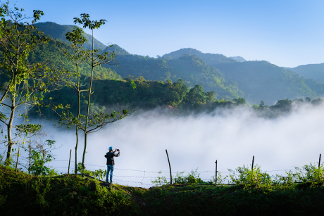
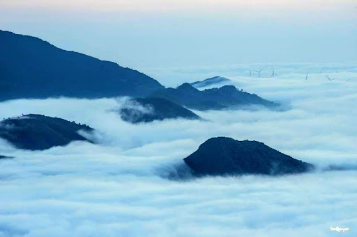
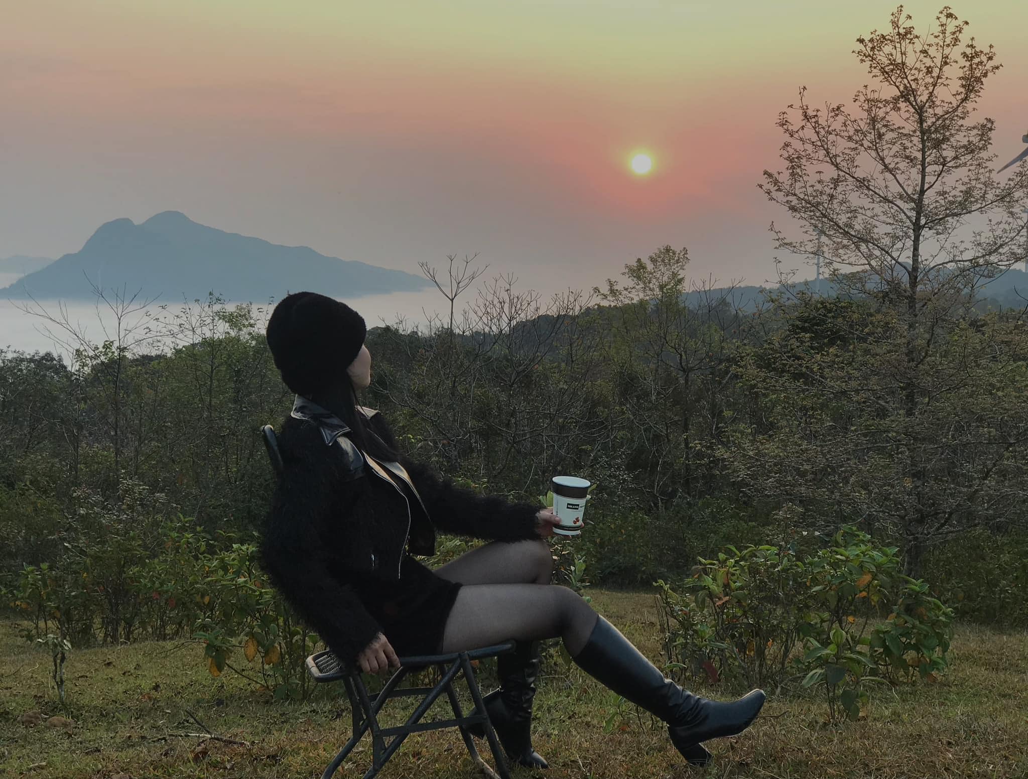
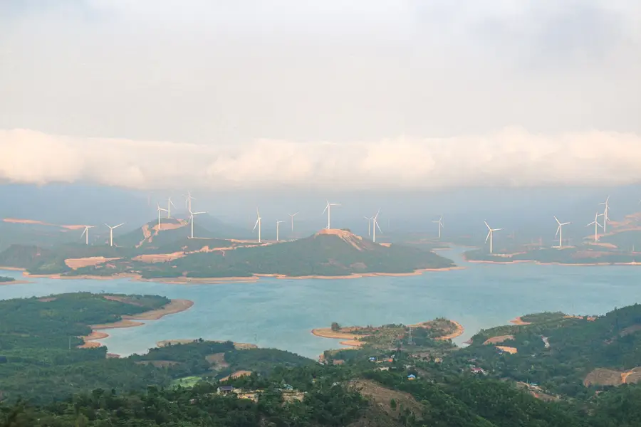
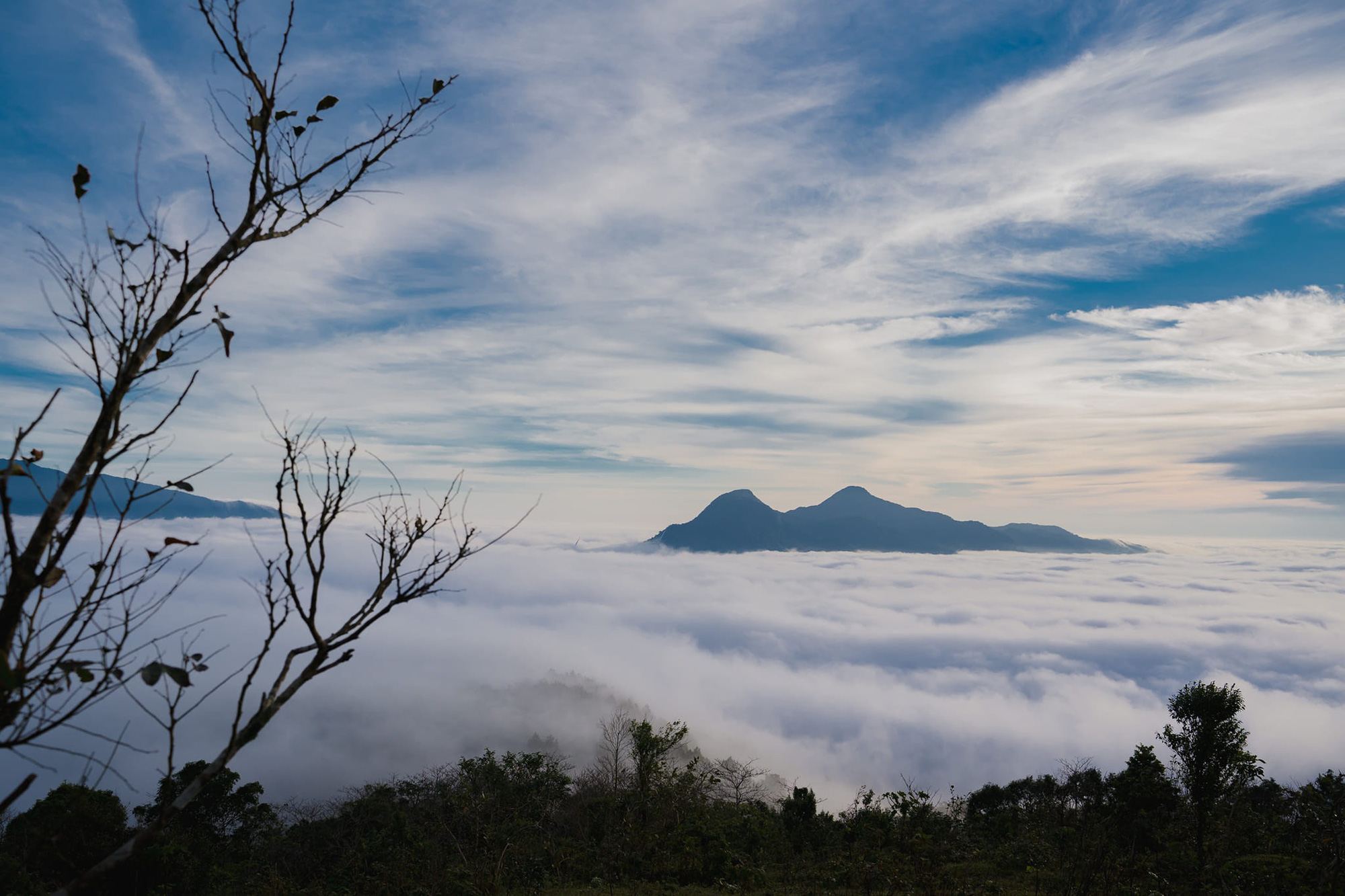


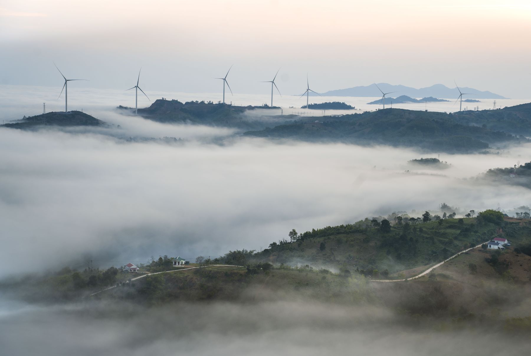
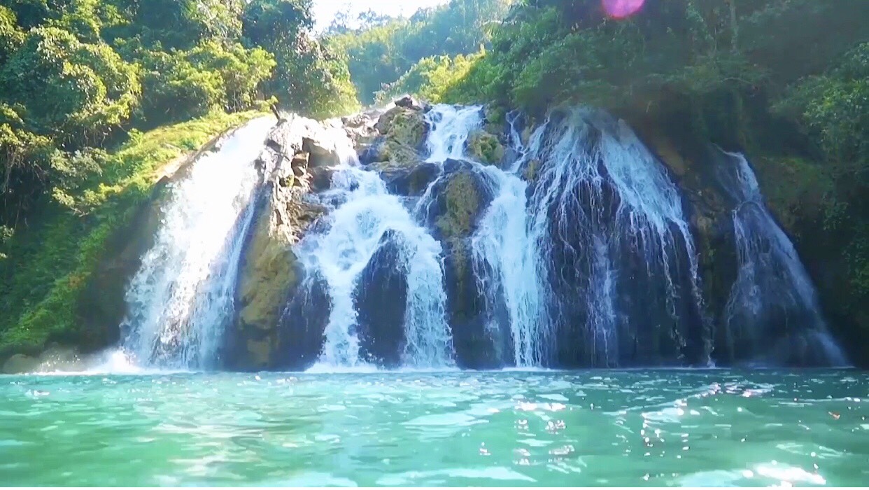
Cu Tai belongs to Huong Linh commune (Huong Hoa, Quang Tri) has long been given a place where the world is surrounded by: "Watching the most beautiful sunrise in Quang Tri province", "The most ideal place to hunt in Quang Tri province" ... and many other beautiful names for this place. From the monument of the victory of Khe Sanh followed Ho Chi Minh road about 10 kilometers to meet a junction. From here, turn left about 2 more kilometers to the top of the cu. Maybe from English, cover is turned into a place, meaning shelter, tunnel cover, outer cover. According to Huong Hoa people, there are 3 hills in this locality, 2 hills in Huong Linh commune and 1 in Phung commune. In the past, when American soldiers control the peaks often put "cu cu" in these places to hide. Although the locality has many hills, whenever they mention, people think of Huong Linh commune. The hill in the direction of Linh is 800 meters higher than the sea level, located in the old village. The old version was founded by the ethnic people of Van Kieu living next to the River River. Until Quan Hydroelectricity was formed, they had to relocate, a part of the village residents on the hill of settlement. However, after the wind power is construction, nearly 100 households in Cu held up again to move to another place. Currently, the four sides of the wind poles, works such as schools, community houses ... almost retain as evidenced by the presence of a small village that has existed in this place, the rest belongs to The management of Phong Lieu wind power plant. From Khe Sanh Victory Monument, going in the direction of Phung commune about 10 km, turning left 2 more to the center of the old village. From here on the hill, I am about 2 minutes to drive a motorbike. Cu Tai is a bare hill with only shrubs, sims and after (Phong Huong) grows. From here there will be a vision (view) million dollars, as the way of speaking of young people now. 360 -degree vision with four clouds and wind. The concrete road from Ho Chi Minh Road to the West branch to the Cu Cu was built by a flat, winding wind power joint stock company. The two sides of the trees are shiny. The road is poor with the steep, very craggy. One side is a cliff, one side is a deep. The eye of the distance is the Blue Hydroelectric Hydroelectric Lake. It was like going through Hai Van Pass to look at the East Sea by the mind of a person standing in the place between the land and the sky. Getting off the pass is a fairly wide "plateau". The terrain is relatively flat with the moderate slope that makes me think of a peaceful village, the smoking pig is located on the top of Truong Son, beautiful and mysterious among the darkness. The village has many houses and buildings but no population. Only the curious guests left far away to hunt clouds, welcome dawn. In order to make Cu grew more and more beautiful, more attractive, Phong Lieu wind power has planted thousands of peach trees and hundreds of cherries. In the near future, this unit will propagate sim, buy indigenous to plant hills where the wind poles. At the beginning of the spring, who had the opportunity to come here, the two sides of the flower road bloomed white, falling into thick carpets on the ground. There are roses of pink cherry blossoms under the yellow sunshine. Beside the cliffs, Cymbidium species with red and white flowers also appear to make the fragrance of the land in this sky gate. From the top of the cu, looking down is the old forest, further than the belt of the Hydroelectricity Lake, furthermore is the field of wind power. Standing here to explain why Huong Linh is the cradle of the wind. By the two sides of the mountain, only one slot in the middle is Huong Linh commune. This slot usually welcomes the wind all year round. But if the wind from the East Sea blows into the mainland, to the direction of the wind, the peak is like a screen in the west of Quang Tri.
Quang Tri 181 view From March to August
Ngày cập nhật : 17/02/2025