Explore the history, culture, people and beautiful landscapes of Vietnam on the 63Stravel travel app
Download the 63stravel app


Ca Mau 859 view

Download the 63Stravel app to immerse yourself in countless beautiful photos of Vietnam

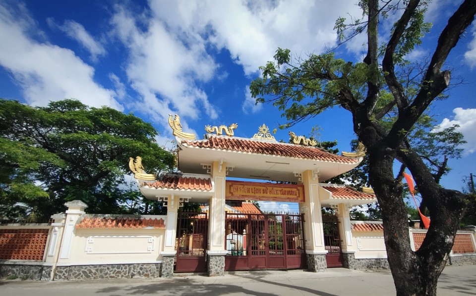
Welcome gate to Khai Long tourist area
Khai Long Beach - "Hidden Pearl" in the beautiful sea and sky at Cape Ca Mau
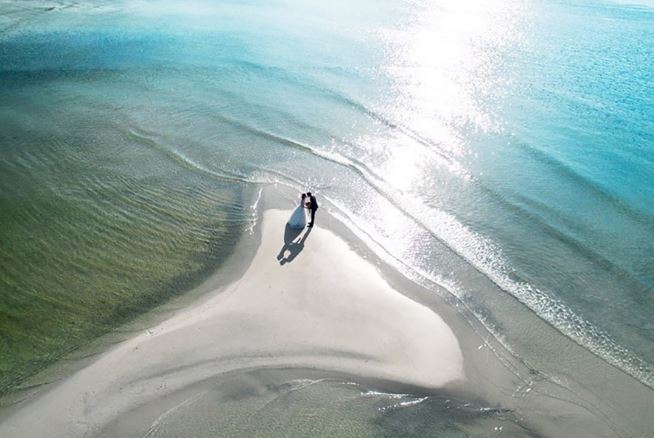
The wild beauty of Khai Long beach
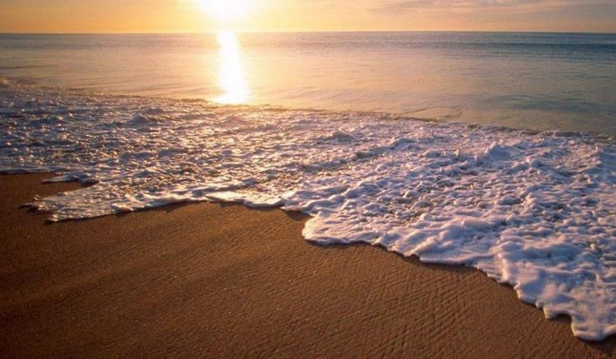
Sunset on Khai Long beach
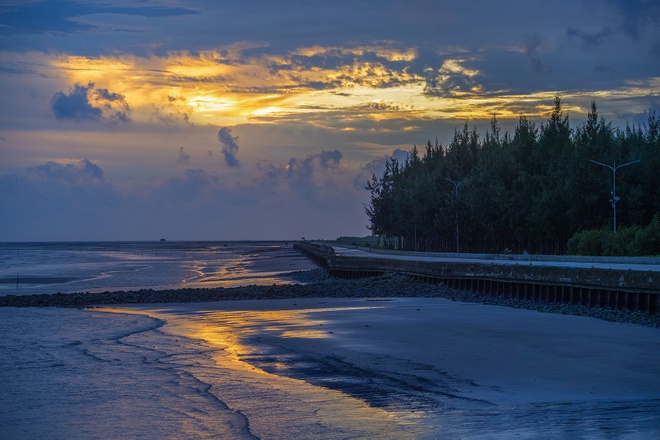
Dawn on Khai Long beach


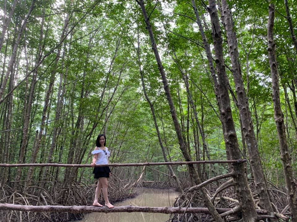
Ca Mau Mui National Park was established in 2003 when Dat Mui Nature Reserve was transformed into a National Park in the system of special-use forests of Vietnam. This is the largest primeval mangrove forest in our country, adjacent to the East and West seas, so it is influenced by both tidal regimes: semi-diurnal tides in the East Sea and diurnal tides in the West Sea, and is the breeding ground for many species. Seafood has economic value and is a stopping point for many winter migratory waterbirds. Currently, Mui Ca Mau National Park has a very diverse number of flora and fauna, with about 28 to 32 species of mangrove trees; about 26 species of mammals, 93 species of birds, 43 species of reptiles, 139 different species of fish, with 9 species of amphibians, 49 species of plankton, and many other rare species... Of which two species are in the The world red book is the long-tailed macaque (Macaca fascicularis), the silver langur (Trachypithecus cristatus) and four species in the Vietnam red book. Cape Ca Mau National Park, the mainland part belongs to the administrative territory of the communes: Dat Mui, Vien An and Dat Moi, in Ngoc Hien district, Ca Mau province, about 100km from Ca Mau city and Ho city. Chi Minh is nearly 400km. Because the distance is quite far, the most reasonable means of transportation is by car or bus. Note that if you ride a motorbike, you need to be healthy and need to rest along the way. In Ho Chi Minh City, to get to Ca Mau, you can travel by bus with reputable bus companies such as Phuong Trang, Giap Diep, Hung Thinh... travel time is about 7-8 hours. In addition, you can book a flight with Vietnam Airlines with a flight time of 1 hour. Depending on the budget you have, choose to travel by car or plane. From Can Tho, you can go along National Highway 1A through the provinces of Hau Giang, Soc Trang, Bac Lieu, then continue about 67km to the center of Ca Mau City. Starting from Ca Mau City, you can rent a motorbike or car to go more than 50km along National Highway 1A for more than 1 hour, visitors will arrive at Nam Can town. From here, go more than 50km along the newly opened Ho Chi Minh Road to Dat Mui commune, Ngoc Hien district. When traveling to Ca Mau to Mui Ca Mau National Park, visitors will be impressed by the unique interesting things of this Dat Mui region. Each destination will be a unique and profound journey of new experiences. Ca Mau Cape National Park has the tourist attraction Ca Mau Cape Culture and Tourism Park, which is the sacred southernmost land of the Fatherland that any Vietnamese people wish to visit once. Coming here, visitors can visit and take commemorative photos at typical symbols of Dat Mui such as GPS coordinates milestone 0001, miniature panels (images of ships), visit the breakwater, and wool symbol. , mudskipper, forest village bridge, landmark at the end of the Ho Chi Minh Trail, Lac Long Quan Temple, Mother Au Co Statue, ... Or walk to the upper floors at the Hanoi Flag Tower project to see the panoramic view of the forest Ca Mau's salty sea, the vast East Sea, and the island cluster of Hon Khoai hidden in the distance. The forest and sea blend together to create a beautiful, poetic scene that is rare to find anywhere else. The people of Dat Mui "revealed" that Dat Mui Ca Mau has many flavors bestowed by the coastal region. Here, there are many delicious dishes such as stir-fried wool snails with coconut, roasted crab with tamarind, braised pineapple fish, cobia cooked with sour rice, brown fish braised with fruit, mudskipper grilled with salt and chili... Especially crab and Ca shrimp. Mau is famous for its sweet taste, fragrant and firm meat in every fiber because it lives in coastal alluvial lands, with mineral-rich alluvium and abundant food. A more interesting part of coming to Mui is enjoying Southern-style meals under the roofs covered with nipa palm leaves, surrounded by cool breezes with fruit wine, known as "Ca Mau wine". ” and listening to amateur music, it's hard to forget. Visitors can also buy as gifts for relatives and friends typical products of Dat Mui region such as: dried shrimp, dried pineapple fish, dried fish of all kinds, fish sauce, mangrove chopsticks, honey, other products. Souvenir bearing the Dat Mui symbol... after finishing the trip to Ca Mau.
Ca Mau 1914 view
From January to December
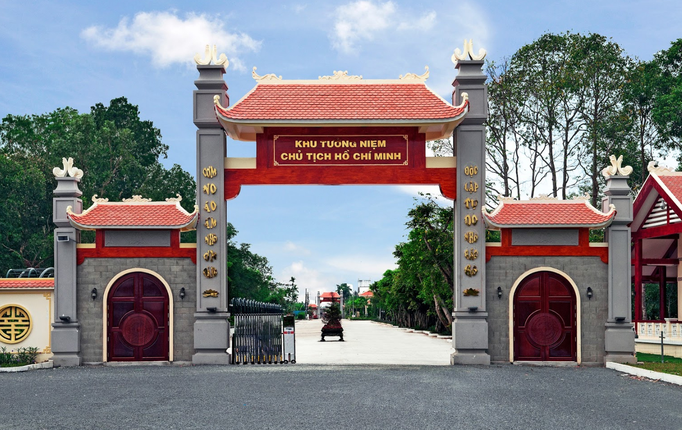
It can be said that Ca Mau is the only province with a bird garden located right in the heart of the city. This unique bird garden is located within the grounds of the President Ho Chi Minh Memorial Area in Ward 1, Ca Mau city, Ca Mau province. With a large campus, many airy and cool green trees, President Ho Chi Minh Memorial Area in Ca Mau is not only a place to commemorate Uncle Ho, but also a tourist destination in Ca Mau that attracts tourists from near and far. President Ho Chi Minh's memorial area includes many works such as: Uncle Ho's worship space (where flower and incense offering ceremonies are held to commemorate Uncle Ho); Uncle lake floor; Bird garden (with an area of more than 3 hectares, the number of resident birds is estimated at over 12,000 individuals); Exhibition house, movie screening (serving the need to learn about the life and career of President Ho Chi Minh);... Harmoniously combined with a system of green trees and ornamental flowers to bring a cool and airy feeling . In particular, this area has many individual birds, storks, etc., coming in flocks and staying crowded, creating a unique bird garden in the heart of the city. Every year, on Tet holiday, birds gather here as if they had been dating forever. The scene of the bird garden in spring is so lyrical and poetic. In the afternoon, the sound of singing calls to you, the sound of flapping wings stirs the whole forest. According to counting results of the Institute of Natural Resources and Environment (under Hanoi National University) and the Royal Institute of Ornithology of Japan in April 2018, this bird garden has about 6,603 individual birds with about 53 other bird species. together. However, the number of birds in the garden fluctuates with each season of the year. At its peak, the garden had more than 10,000 birds coming to nest, breed and settle in the artificial bird garden in the heart of Ca Mau city. Most of these birds are storks (white storks, storks, storks), pileated gongs, cauldrons, red-necked birds (also called snake-necked birds) and gray herons. If you have the opportunity to travel to Ca Mau, this will be the closest and interesting place to visit for all tourists. Just less than 6 meters from a ditch, visitors will witness with their own eyes tens of thousands of birds, storks, gongs, teals, cauldrons, waterfowl, waterfowl... flying down to the mangrove forests and crowded bamboo banks. This bird sanctuary has existed for decades and has always been carefully and thoughtfully protected by the locality. Despite the streets and construction projects developing around it, the bird garden still exists as a precious feature of a city in the southernmost region of the country.
Ca Mau 1942 view
From January to December
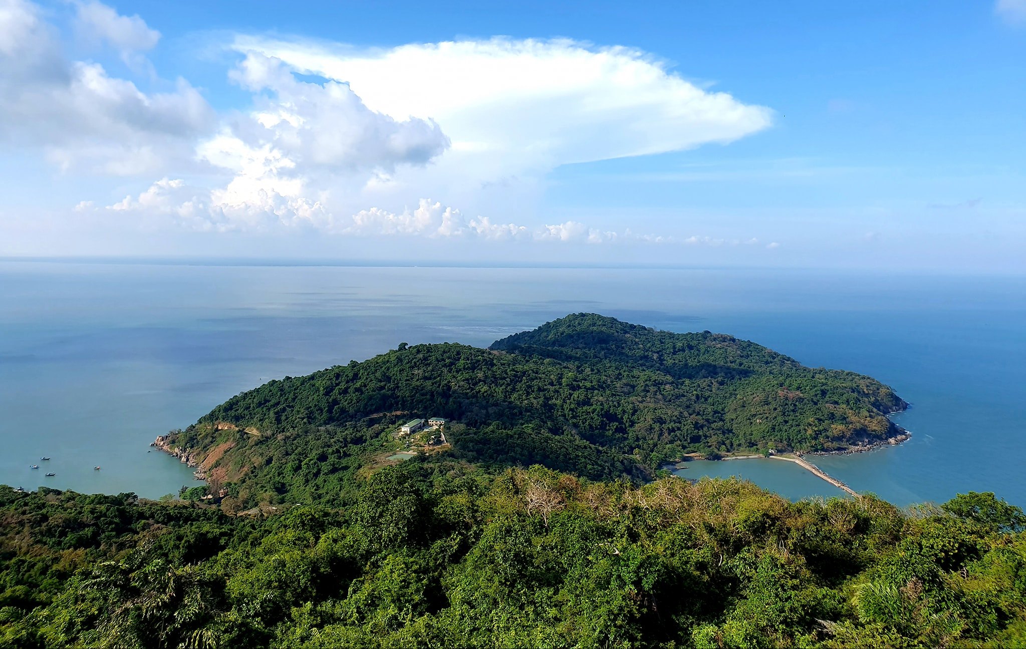
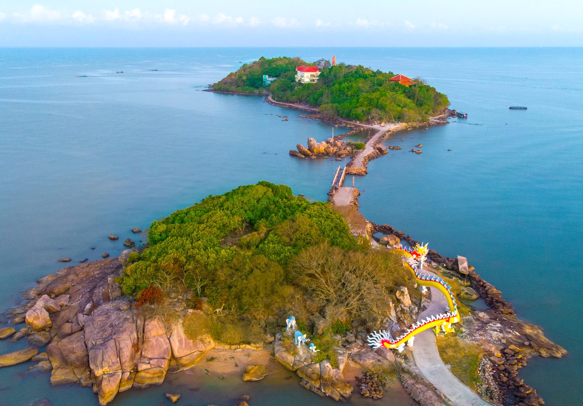
Hon Khoai is the name of a cluster of islands located southeast of Ca Mau cape in Tan An commune, Ngoc Hien district, Ca Mau province. Hon Khoai is more than 6 nautical miles (14.6km) from the mainland and has an important position in national defense and security. This place is considered a forward station guarding the air, sea and land in the southwest of the country. Hon Khoai Island includes many small islands: Hon Khoai, Hon Tuong, Hon Sao, Hon Doi Moi, Hon Da Le. Hon Khoai is the largest island with an area of about 4km2 and is also the highest island above sea level at 318m. In the past, this place was also known by many different names such as: Giang Huong Island, Doc Lap Island or Poulop Island during the French period. However, because of its shape like a giant potato, local people still call it Hon Khoai to this day. With a mild climate, not hot and dry all year round, visitors can visit Hon Khoai at any time of the year. However, to fully enjoy the beauty of Hon Khoai, you should come here during the dry season from November to April every year. For tourists in the Central or Northern provinces, you can choose to fly to Tan Son Nhat airport in Ho Chi Minh City then take a bus or rent a motorbike to Ca Mau with a ticket price of about 500,000 - 800,000 VND/ afternoon. For tourists in the South, with the developed inter-provincial bus system, you will not lose too much money and time if you choose a passenger car as a means of transportation. Some bus companies such as Phuong Trang, Thanh Buoi, Van Lang, Viet Hoang are operating routes to Ca Mau from the provinces with ticket prices of only about 100,000 - 150,000 VND/trip. In addition, if you are in the Western provinces, traveling to Hon Khoai by personal vehicle will bring many interesting experiences along the way. With a distance of about 300km from Ho Chi Minh City to Ca Mau, it will take you about 6-7 hours to travel by this type. Hon Khoai is an island of rocks, hills and primitive forests that are almost intact with many precious woods and rich flora and fauna, which has captivated many tourists. According to the latest research, the flora in Hon Khoai has more than 1,400 species including fruit trees, timber trees, medicinal trees... Animals are also quite rich with monkeys, wild chickens, pythons, monitor lizards, squirrels. white... and more than 20 species of precious birds. On the island there are 2 beaches, including Bai Lon in the southeast and Bai Nho in the north. When visiting Hon Khoai, the tourist boat will stop at Bai Nho, from there take a small boat to the shore about 50m. The first time you set foot here, visitors will be overwhelmed by the beautiful scenery. The most unique feature of this island is that the beaches have many strange round pebbles like goose eggs. Mother nature also favors this place with shady maple trees and casuarinas swaying in the cool breeze. When spring comes on Hon Khoai, apricot flowers bloom brightly yellow all over the island. Hon Khoai has a long, sheltered coastline, an anchorage and storm shelter for fishermen and a breeding and sheltering place for many marine species. From tiny plankton species to aquatic species with high economic value such as: squid, lobster, mantis shrimp, grouper, cobia,... Hon Khoai beach has wide sandy beaches. When the tide is low and the sea is calm, visitors can walk on the sand to learn about marine life and breathe the fresh air of the forest and sea. The road on the island has one main road from Bai Lon to the top of the island, about 3 km long, paved with smooth asphalt and shaded by green trees. What is special is that there are two streams on the island, providing fresh water all year round for units stationed on the island and fishermen fishing around the area. It is said that, because ancient fairies came down to this sweet stream to bathe, the island has since then been named Giang Tien. Because the island has few residents, there are only a few small grocery stores, mainly staffed by border guards guarding the island. Because of that, Hon Khoai still retains its wild beauty that is rare to find anywhere else. The most prominent building is probably the 100-year-old lighthouse - a place you cannot miss when coming to Hon Khoai. This tower is located on the highest peak of Hon Khoai, built by the French colonialists in 1920, this is considered one of the earliest lighthouses in Vietnamese waters. Traveling to Ca Mau, coming to Hon Khoai, you cannot miss the sea specialties with extremely attractive dishes such as: sweet potato fish, cobia fish, lobster, mud crab, grilled mantis shrimp,... Aromatic flavor Delicious and nutritious, the seafood dishes here become an interesting highlight and leave an unforgettable impression in the hearts of visitors. What makes tourists always remember Hon Khoai is probably the sincere hospitality of the island's soldiers, who guard the sea and sky for their homeland island day and night. And surely when leaving, visitors will love the beautiful Hon Khoai even more.
Ca Mau 1908 view
November to April every year
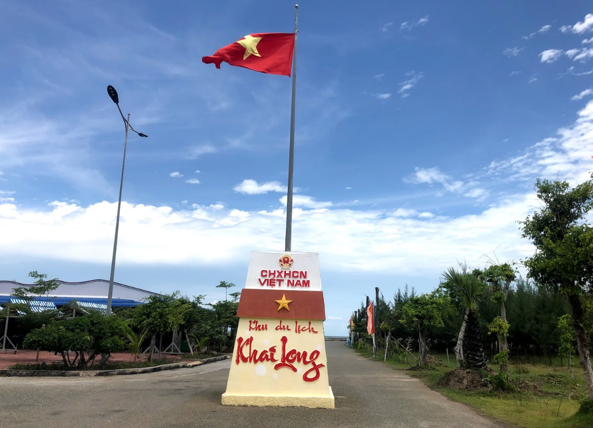
Khai Long beach, located in Dat Mui hamlet, Dat Mui commune, Ngoc Hien district. Khai Long beach is located between two canals, But Mien and Khai Long. This is a golden sand beach stretching from a few dozen meters to over 100 meters, running nearly 4km long. The beach is 230 hectares wide and continues to reach the sea every year. When the tide is low, the sandy beach gradually widens and forms beautiful long, wavy sand beaches. The coast here is still wild and majestic with a clean ecological environment, surrounded by a marine forest ecosystem. Inside the beach, there is sea water spinach growing wild, blooming purple flowers like wallflowers. Along the Khai Long coast, there are many shrimp, fish, shrimp, cockles, clams... living and residing. Adjacent to Khai Long beach is Ca Mau Cape National Park (located in the world biosphere reserve of Ca Mau Cape). This place has Nam Can mangrove forest, Ca Mau Cape and is adjacent to Hon Khoai island cluster, Vam Lung wharf where weapons are received from the North to the South along the Ho Chi Minh Sea route. Source: Ca Mau Geography Board of Directors
Ca Mau 1856 view
U Minh Ha National Park is an ideal destination for those who love the natural and wild beauty of Dat Mui Ca Mau river. As a large-scale biosphere reserve, U Minh Ha is famous for its green vegetation, diverse ecosystems and unique natural scenery. U Minh Ha National Park is located in the west of Ca Mau province, within the administrative boundaries of 4 communes in 2 districts of U Minh and Tran Van Thoi. U Minh Ha is about 40 km from Ca Mau city center and can be reached by car. The total area of the forest is up to 8,527 hectares, one of the three core areas of the Ca Mau Cape World Biosphere Reserve. This place is famous for its Melaleuca forest ecosystem formed in alum, flooded conditions, and on peat soil. The ecosystem is diverse and rich with more than 250 species of plants, 40 species of mammals, 182 species of birds, 20 species of reptiles, amphibians and many other insect species. Among them, there are many rare species listed in the Red Book of the International Organization for Conservation of Nature. The weather in U Minh Ha is divided into two distinct seasons: dry season and rainy season. The dry season starts in May and ends in October, the rainy season lasts from November to April of the following year. According to U Minh Ha travel experience, visitors can visit and explore this National Park at any time of the year. The rainy season is when the water level is high, making it easier to travel by boat around the mangrove forests. On the contrary, the dry season will be more favorable for sightseeing because it is sunny and there is no rain. If you want to come here to explore the ecosystem or take check-in photos, the dry season will be a more ideal time. From City. Ho Chi Minh, there are 2 ways to get to U Minh Ha National Park. If traveling by motorbike, from City. Ho Chi Minh City, you can follow National Highway 1A, cross Ca Mau bridge to Ngo Quyen and Vo Van Kiet streets, follow the signs to reach U Minh Ha forest. On the way, you should ask local people to avoid getting lost. If traveling by bus, City Line. Ho Chi Minh - Ca Mau has passenger buses departing from Eastern, Western or An Suong bus stations. Bus ticket prices usually range from 180,000 - 200,000 VND/ticket. Reputable bus companies that you can refer to are: Phuong Trang, Lien Hung, Ngoc Ha, Mai Linh, Giap Diep... From Ca Mau bus station, take a taxi or motorbike taxi to get to U Minh Ha. Most tourists coming to U Minh Ha National Park go back and forth during the day, not staying overnight. Accommodation services around the forest are not yet developed, so you can stay at motels and hotels in Ca Mau city. U Minh Ha travel experience also shows that staying in the city center will be more convenient for moving and exploring other tourist destinations. When visiting U Minh Ha forest, you can participate in activities such as: Admiring the scenery of U Minh Ha forest from the observatory, Visiting the mangrove forest by boat, Fishing and collecting honey in the forest,... In addition, you need to note the following points when traveling to U Minh Ha Forest. First, bring a hat and umbrella to protect yourself from the sun, and choose comfortable clothes for ease of movement. Second, if you come here during the rainy season, you should wear long clothes and apply insect repellant cream to avoid mosquitoes. Third, call the Management Board in advance if you want to experience the boat trip to visit the U Minh Ha mangrove forest. Fourth, watch the time to get out of the forest, do not stay alone or sleep overnight in the forest to ensure safety. Finally, do not cut down trees or harm animals in the forest.
Ca Mau 1995 view
From January to December
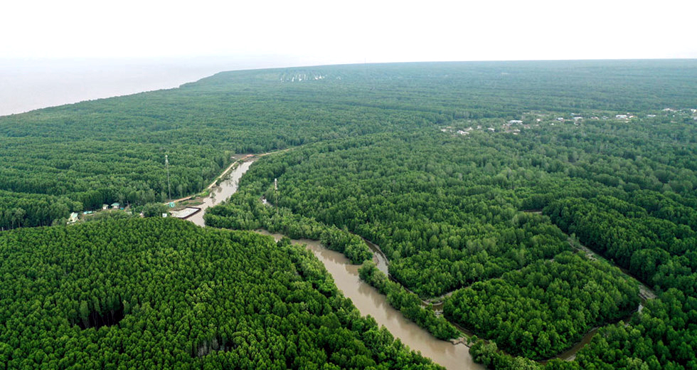
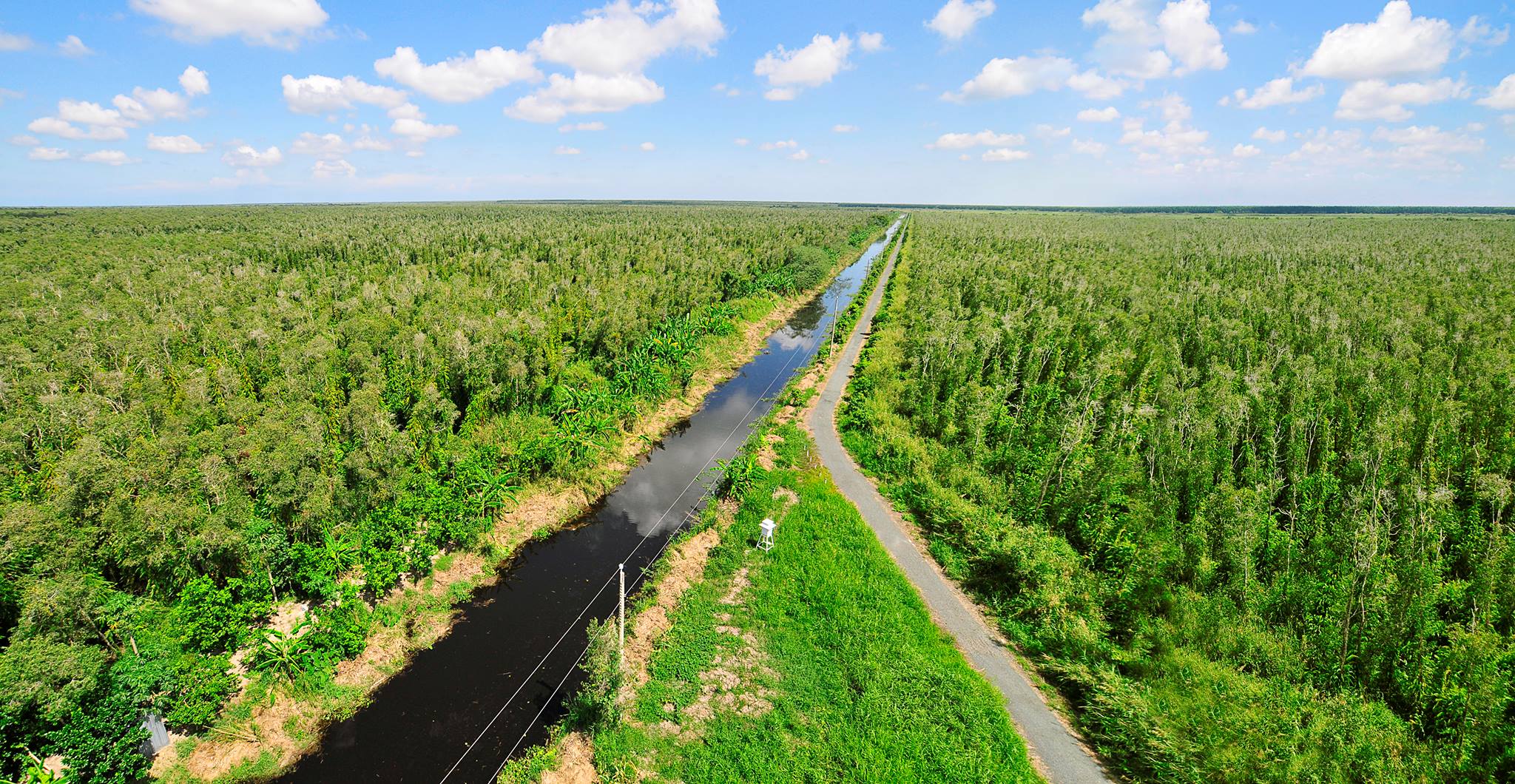
Ca Mau mangrove forest or Nam Can mangrove forest is a famous mangrove forest in the West. The forest has formed a solid protective membrane, preventing sea erosion, helping to control landslides and maintaining ecological balance. Coming here, tourists traveling to Ca Mau can not only visit, but can also participate in many other interesting outdoor activities such as boating, fishing and enjoying closeness to nature. During the resistance war against the French and the Americans, Nam Can mangrove forest became an important shelter for the revolutionary army. With its rugged river terrain, it played an important role in preventing enemy attacks and destroying small naval campaigns on the river. With the second largest area in the world, the mangrove forests here are second only to the Amazon forests of Latin America. The total area of the mangrove forest is 63,017 hectares, which is a habitat for many diverse species of creatures. When viewed from above, the forest looks like a V-shaped peninsula, with three sides facing the sea. Nam Can Ca Mau mangrove forest is a land with a quite pleasant climate. The best time to explore this land is during the dry season, from December to April. During this time, the air is dry and cool, creating favorable conditions for sightseeing and experiencing. However, from May to November, the long rainy season can hinder tourism activities. In particular, if visitors plan to tour Ca Mau in July or August, they will have the opportunity to enjoy many more delicious and attractive specialties. To visit Nam Can mangrove forest, visitors must travel by tourist boats, along both sides are rows of mangrove trees. Floating on the boat, the deeper you go, you will clearly feel the fresh and cool air. While walking, I heard local people tell stories about the origin of this forest. It's very interesting, isn't it? Going deeper inside, visitors will see wild, majestic natural scenes, the gradual appearance of an almost unexplored core of primeval forest. There are ancient trees with huge trunks that 5 to 6 people cannot hug... This place is extremely worthy of being chosen as the most attractive tourist destination in Ca Mau. Not only that, visitors also have the opportunity to see thousands of flocks of birds converging on the branches of mangrove trees, creating an extremely beautiful and interesting scene. Just by raising the camera, visitors will see countless wonderful photos with interesting scenery appearing before their eyes.
Ca Mau 1999 view
From May to November
Saraymel Chey Pagoda (Cao Dan Pagoda) is located in hamlet 7, Tan Loc commune, Thoi Binh district, Ca Mau province. Cao Dan Pagoda is located next to Highway 63 (in hamlet 7, Tan Loc commune, Thoi Binh district), about 16 km north of Ca Mau city center. Cao Dan Pagoda was built in 1922 on an area of 4 hectares, at the intersection of Duong Cay canal, donated by Mrs. Diep Thi Lai. At that time, people often called Chau Trang Pagoda (Bach Nguuu). After being burned by the enemy many times, in 1998, Cao Dan Pagoda was newly built. Inside the main hall of the pagoda there is a large altar, worshiping only Shakyamuni Buddha. Opposite the main hall is the Venerable Huu Nhem tower, built in 2003, 17m high, 12m² area. In 1954, the Geneva Accords were signed, we had to bring a group of core officers and children to the North, choosing Cao Dan Pagoda as the study center for the core officers and children. rolled in the province to send to the North. The remaining core cadres used their legal positions to the fullest extent; the cadres who had not yet been exposed were infiltrated into the enemy's ranks. The number of officials revealed to be roaming the operating area or withdrawing into secret. Revolutionary organizations were also reorganized and transformed to suit the situation at that time. On the other hand, Cao Dan Pagoda was directed by the Party to move next to bridge highway No. 6 (National Highway 63), to avoid enemy observation. At the same time, there are people's houses as security shields to make operations easier. During the two resistance wars against the French and the Americans, the Board of Directors and the monks and Buddhists of Cao Dan Pagoda were closely associated with the revolution. Cao Dan Pagoda is the secret base of the revolution. Among them, Venerable Huu Nhem, former abbot of the pagoda who passed away during the resistance war against the US, held the position of Vice Chairman of the National Front for the Liberation of the Southwest Region, actively campaigning for monks and the Management Board. ruled over pagodas and a large number of local Kinh - Hoa - Khmer ethnic people participated in the resistance war against the Americans to save the country. The enemy repeatedly bombed and destroyed the temple; Many monks and Buddhists heroically sacrificed their lives. Today, at Cao Dan Pagoda there are still many unfilled bomb craters, proving that the enemy's destruction cannot overshadow the rebellious and patriotic spirit of Buddhists and monks. During the process of formation and development, Cao Dan Pagoda has not only performed the task of maintaining religion, but also performed well the tasks of a patriotic citizen, always attached to the nation and the leadership of the Party and the strong revolution that has been created. The results are very appreciable. At the same time, we must not separate from the great national unity bloc to participate in the struggle against French and American invasion, contributing to completely liberating the South and reunifying the country. On December 29, 2017, Cao Dan Pagoda was decided to rank as a national monument by the Minister of Culture, Sports and Tourism. Source: Ca Mau Province Electronic Information Portal
Ca Mau 1849 view
The victory site of Dam Doi - Cai Nuoc - Cha La, belongs to Cha La hamlet, Tran Phan commune, Dam Doi district, Ca Mau province. In September 1963, the Regional Party Committee, the Military Region Command (T3), the Provincial Party Committee and the Military Command of Ca Mau Province advocated opening a military attack campaign, aiming to destroy and destroy enemy forces and support the enemy. The masses rose up and expanded the liberated zone in South Ca Mau. Cai Nuoc and Dam Doi were two sub-districts (district capitals) in the south of Ca Mau, 20km apart, chosen as the main targets. The Military Region Command decided to destroy Dam Doi and Cai Nuoc Sub-Regions in one night, attack surrounding posts, and block enemy reinforcements. At the same time, step up attacks on enemy rear bases, airports, and command posts in Can Tho, Soc Trang and other provinces. Attack the enemy with 3 armored attacks, uproot fortresses, and destroy strategic hamlets. The time for shooting to destroy the two branches was uniformly determined on the night of September 9 and early morning of September 10, 1963. Dam Doi and Cai Nuoc Branch, built with a solid structure since 1955. This place became a place of strict defense of the enemy with a complex protection system; including steel barricades, minefields, and strategic watchtowers, etc. At Dam Doi Branch, U Minh Battalion 1 conducted a courageous and intelligent attack strategy. After two fierce hours, the army and people here destroyed the Dam Doi war zone, destroyed 110 enemies, captured 48 alive and seized many military weapons. The victory at Cai Nuoc was no less impressive. Battalion 306 attacked strongly on the night of September 10, 1963. As a result, 92 enemies were destroyed, 84 were captured and many important military weapons were captured. Cha La is also a location that suffered a comprehensive attack by our army. After more than 3 hours of fierce fighting, our army destroyed the Cha La base and completely defeated the enemy. The result was the capture of 30 enemies and the seizure of many types of weapons. These battles not only destroyed the enemy but also contributed to destroying the US military's "helicopter and parachute" strategy. Those victories not only expanded the liberated area; but also the clearest testament to the strength and fighting spirit of the Southern army and people in the war against America to save the country. The victory of Dam Doi - Cai Nuoc - Cha La was a great success of our army and people in implementing the "two legs, three prongs" approach (armed - political - political - military), promoting strength. The synthesis of the people's war, the victory of Dam Doi - Cai Nuoc - Cha La were two of the seven major victories of the Southern army in 1963. We destroyed many enemies, removed many posts and destroyed every hamlet. strategy, the liberated area was expanded, the Cha La battle not only eliminated the enemy from the battle but also contributed to defeating the US-puppet "helicopter and parachute" tactic. On August 18, 2016, the historical relic Dam Doi - Cai Nuoc - Cha La victory site was decided to rank as a national historical relic by the Ministry of Culture, Sports and Tourism. Source: Ca Mau Province Electronic Information Portal
Ca Mau 1844 view
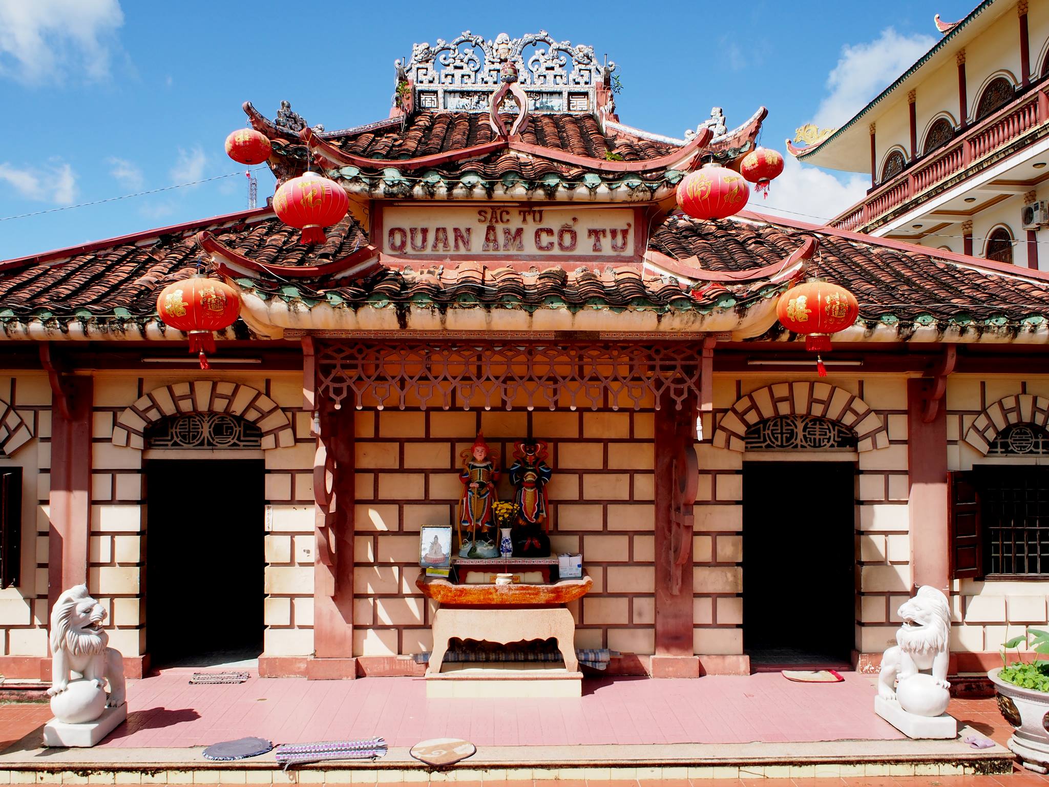
Phat To Pagoda is located in Ward 4, Ca Mau city. The pagoda was built in 1840, bearing the ancient architecture of the 19th century. This is the earliest place to propagate Buddhism in Ca Mau. The original name of Phat To Pagoda is due to the long-standing respect of the people of Ca Mau region to the monk who built the pagoda: Venerable Thich Tri Tam. Legend has it that around 1840, Ca Mau area was a reed area. Following the flow of people going to reclaim the land, there was a young man, To Quang Xuan, who went to collect firewood in the forest. When the ax hit the trunk of an ancient Bodhi tree, a tree appeared. The Buddhist scriptures were placed at the base of the tree. From then on, the young man built a shrine to worship Avalokiteśvara while cultivating and taking medicine to treat people on the banks of Quan Lo canal. Legend has it that To Quang Xuan recited the Diamond Sutra to transform wild beasts. People who know the language come in large numbers to ask for medicine and learn religion. Among these disciples, even ferocious tigers also came to learn the Dharma. Currently, that tiger's tower still exists, and the disciples in the temple call it Su Cau's tower. Later, thanks to people's contributions, To Quang Xuan built a simple temple made of leaves. Seeing this, Do Van Vien in the area was jealous and accused him of being a dishonest Taoist. He was arrested by superiors and brought to Saigon (now Ho Chi Minh City) under house arrest. But To Quang Xuan's morality made the mandarins admire him. He was brought back to Hue and ordained as a monk at Kim Chuong Pagoda. Seven days after receiving the precepts, he passed away. The king ordained him as a "monk" and at the same time bestowed brocade and sent people to bring his remains back to Ca Mau. Feeling sorry for him, in 1842, King Thieu Tri (Nguyen Dynasty) decreed that To Quang Xuan be ordained as Venerable Thich Tri Tam, repaired his thatched hermitage next to the old forest and decorated the pagoda with the name " "The Four Avalokitesvara Ancient Temple". Venerable Thich Tri Tam is revered by the people in the area as "Buddha Patriarch", so the pagoda is also called "Buddha Patriarch Pagoda". Phat To Pagoda has been renovated many times, the major restoration was in 1937. However, the original state of the ancient pagoda is still basically maintained. Worship artifacts such as wooden statues, wooden trays, single vases, bronze bells, parallel sentences, ordained orders from the king... are still preserved, proving the development of Buddhism during the period when the Vietnamese people began to make strides. important in the work of reclamation and forming a communal society with the three ethnic groups Kinh, Chinese, and Khmer in the southern land. During the resistance war against America, Buddha Pagoda was a place to hide revolutionary soldiers. On November 24, 2000, Phat To Pagoda was recognized by the Ministry of Culture and Information as a national historical and cultural relic. In addition to the main architecture of the ancient temple, on the right from the temple gate, there is also the office of the Executive Board of the Buddhist Association, Ca Mau Buddhist Intermediate School, and the office of the Special Committee for Nuns. On the left of the main architecture, there is also the free Tue Tinh hall for the poor, the Buddhist Family Assembly Hall, the Sangha house... Every week, Buddhist studies and lectures are held here. Every year, on every major Buddhist festival such as the full moon ceremony in January, Buddha's birthday, Vu Lan... Buddha Pagoda becomes a place for festivals, a large number of monks, nuns, and Buddhists gather to attend. Source: Ca Mau Tourism
Ca Mau 1740 view
Hon Da Bac is about 500 meters from the mainland, has an area of 6.34 hectares, located in the west of Ca Mau Peninsula, in Kinh Hon hamlet, Khanh Binh Tay commune, Tran Van Thoi district, Ca Mau province. Silver Rock includes Ong Ngo Rock, Silver Rock, and Odd Silver Rock. The highest peak of the island is about 50 meters above sea level. Although not a large island, Hon Da Bac is very convenient for all types of marine vehicles to anchor and avoid storms. Along with Hon Khoai, Hon Chuoi, Hon Da Bac is one of the island clusters with a strategic economic - defense - security position in the sea - Ca Mau island. Looking on the map, Hon Da Bac looks like a forward station guarding the air and sea southwest of Cape Ca Mau. Silver Rock - as its name suggests - around the island, on the water surface, and on the seabed, thousands of granite stones of all sizes lie on top of each other, forming many shapes as if arranged by humans. Walking on Hon Da Bac, visitors encounter Fairy hands, Fairy footprints, Fairy wells, and tiger feet. On the eastern peak of Hon Da Bac, there are large rocks and a fairly wide surface. Between the two pieces of rock there is a deep hole shaped like a foot. Legend has it that that footprint is the Fairy's foot, and this piece of rock is the Fairy's yard. On the island there are a few small temples such as Hang Pagoda and Tinh Do Pagoda. In particular, on the highest peak of Hon Da Bac is Ong Nam Hai temple - a place to worship the 13m long Ong fish skeleton. On May 20, 1995, Ong fish drifted into the Ong Doc river mouth area. About 3 days later, Ong Giat (died), Song Doc fishermen buried him and in 1996 brought the skeleton to Hon Da Bac to worship. Whenever fishermen in this area encounter big waves or strong winds when going to sea, they are saved by Ong fish. Therefore, the fishermen here silently thanked him and worshiped him as a god who saved humanity. Legend has it that Ong Nam Hai temple is very sacred. Today, not only fishermen in the area but also tourists from everywhere who hear his sacred voice come to pay their respects and pray for him to bless his family with peace, without encountering troubles or troubles. During the years of resistance against the US to save the country, the enemy chose Hon Da Bac as the place to station the 105 mm artillery platoon to control the Khanh Binh Tay revolutionary base area and the western coastal line of Ca Mau. This is also the location where the CM12 project took place, defeating the plot to import, sabotage, and overthrow the socialist regime in our country by the reactionary organization "Vietnam Restoration" led by Le Quoc Tuy and Mai Van Hanh. head. On June 22, 2009, the Ministry of Culture, Sports and Tourism recognized the relic: Hon Da Bac - CM12 Counterintelligence Plan Command Center (September 9, 1981 - September 9, 1984) as a Monument. national history and culture. The Ministry of Public Security and Ca Mau province built the CM12 Victory Monument, Traditional House, and Uncle Ho temple at this famous relic. Source: Ca Mau Province Electronic Information Portal
Ca Mau 1732 view
Tan Hung Communal House was the first place to hang the flag of the Indochinese Communist Party in Ca Mau (in 1930) and was also the headquarters of the Tan Hung Front Command, the anti-French front in Ca Mau. Tan Hung communal house is located in Tan Hung hamlet, Ly Van Lam commune, Ca Mau city. Tan Hung Communal House is an ancient communal house worshiping the God Hoang Bon Canh, built by people in 1907. However, due to time and war, the communal house was completely destroyed. On the old ground, local people built another smaller communal house. In 2014, Tan Hung communal house relic was upgraded and restored including many items and works. The main communal house consists of one room and two wings, the roof is covered with yin and yang tiles, and on the roof are cast two flanking dragons. In front of the communal house is a tiger-shaped brick screen, on both sides there are two square brick pillars, the top of the pillars is covered with two stone lotus flowers. On both sides of the yard there are two small temples worshiping the God of Agriculture and the God of Earth. The main altar space of the communal house worshiping the God Hoang Bon Canh is majestically arranged with pedestals displaying swords, spears, drums, images of dragons and cranes. Tan Hung Communal House also has a space to worship Uncle Ho's image, placed in a solemn position. Tan Hung communal house was once awarded the title Bon Canh Thanh Hoang by King Tu Duc in the 5th year of Tu Duc (1852). Elders in the area said that on King Tu Duc's regalia were written the eight words "Righteousness - Huu gentleness - Don stop - Chi Than". The sacred spirit has now been lost due to the chaos of war. In the temple, there is still a sacred spirit container engraved with a winding dragon image. Every year, on the 10th and 11th days of the 5th lunar month, people in the region and tourists from everywhere come here to attend the Ky Yen ceremony at Tan Hung communal house. In addition to its spiritual meaning, paying respect to the gods and protecting tutelary gods, Ky Yen ceremony also aims to commemorate those who have contributed to the country and have fallen on this land. Tan Hung communal house has great cultural and historical value. At the same time, it is an image of preserving and promoting the cultural identity of Ca Mau province, the southernmost region of the country. For many generations, for local people, the communal house is the place where they entrust their dreams and aspirations for a peaceful, prosperous and happy life. Not only is it a place for cultural and religious activities of the people in the region, Tan Hung communal house is also a famous communal house in the history of struggle of the people of Ca Mau. Tan Hung Communal House is the first place in the province where the event of hanging the flag of the Indochina Communist Party (predecessor of the Communist Party of Vietnam) took place on the top of the poplar tree in front of the communal house. The red hammer and sickle flag has the words: "Eliminate the Dharma bandits". For the first time, the people of Ca Mau saw the Party flag publicly appear. And also here, on March 1, 1946, the Tan Hung Front was established. With the meaning of marking many historical revolutionary events, on August 4, 1992, Tan Hung communal house was ranked as a National Historical - Cultural Monument, becoming a "red address" for the young generation to learn about. , learning about historical values, culture, and traditions of fighting to protect the country that our ancestors left behind. Source: Ca Mau Tourism
Ca Mau 1731 view
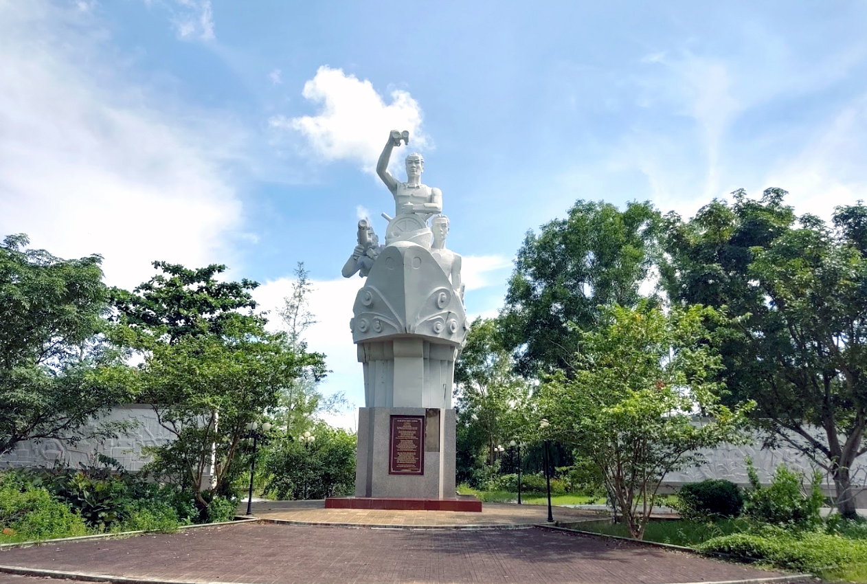
Ben Vam Lung Khom 8 historical site, Rach Goc town, Ngoc Hien district, Ca Mau province. This is the place to record the silent victories of the soldiers on the "Unnumbered Train" that crossed thousands of kilometers by sea, transporting weapons to support the Southern battlefield during the years of resistance against the US to save the country. created the miracle of the Ho Chi Minh Trail at sea. Due to pressing requirements for weapons and ammunition to be supplied to the Southern battlefield, the Politburo and the Central Military Commission instructed the Southern provinces to prepare yards and organize forces to receive weapons from the region. North for the South. Vam Lung Cua is the name of the local people, on the map it is written as Nang River, originating from the East Sea, outside the coast there is mud flats, on the right side is Xeo Lo canal. Vam Lung gate is over 100 m wide and has a water depth of 4-5 m, convenient for ships carrying over 30 tons to enter and exit easily. On October 11, 1962, the first train of the "unnumbered train", bearing the name "Phuong Dong 1", carried 30 tons of weapons from Do Son wharf, Hai Phong, opening the way to the South. On October 16, 1962, the ship Phuong Dong 1, commanded by captain Le Van Mot and political officer Bong Van Dia, crossed thousands of nautical miles under the surveillance and siege of enemy ships but still safely docked at Vam Lung. . This is the train of the "Train without number" opening the strategic transport route in the East Sea - the Ho Chi Minh sea route. After the successful return of the ship "Phuong Dong 1", the ships "Phuong Dong 2", "Phuong Dong 3", "Phuong Dong 4" continued to dock at Vam Lung Wharf to bring hundreds of tons of weapons from the region. The North moved in to support the Southern battlefield. By the end of 1970, Ben Vam Lung received over 70 ships with more than 4,400 tons of weapons and ammunition. Thanks to the rugged terrain, along with a network of canals and canals, above are covered with mangrove and fish sauce forests, creating ideal conditions for revolutionary soldiers to easily transport and hide weapons. Besides, the support and protection of the Rach Goc People are like "iron citadels and bronze citadels" to protect the revolution. Thanks to that, for more than 10 years of operation (1962-1972), our operating bases were safely protected, even though they were located not far from the enemy's military zone in Nam Can. Ben Vam Lung historical site is also associated with the birth of the military unit with the name "Group 962" (established on September 19, 1962) with the task of protecting the safety of trains. entering and exiting the yards, secretly receiving and hiding weapons and transporting weapons to liberation army units for combat purposes. Group 962, later Regiment 962, was twice awarded the title "Hero of the People's Armed Forces" by the State. Due to special requirements during the war period, it was necessary to maintain absolute secrecy and safety for activities of organizing the transportation of weapons, military equipment, and military supplies from the North to support the Southern battlefield, so the artifacts is not kept. However, there is still a damaged wreck of ship 69 of convoy 962, located at Xeo Gia peak about 8 km west of the wharf. To remember and honor the resounding and immortal victories of the Numberless Train, the Ho Chi Minh Trail Victory Monument at sea; A house displaying traditional documents and a number of related works were built at Ben Vam Lung. On October 23, Ben Vam Lung Historical Relic Area was recognized by the Ministry of Culture, Sports and Tourism as a national historical site. Source: Ca Mau Tourism
Ca Mau 1641 view


 vn
vn en
en ja
ja ko
ko zh
zh VIP member benefits