Trekking through the primeval forest, hunting clouds on the top of Sa Mu - U Bo
(SGTT) - Sa Mu - U Bo peak, commonly known as Sa Mu peak, has an altitude of 2,756m above sea level. This mountain peak is located in Ta Xua special-use forest, in Bac Yen district, Son La province.
Come to Xim Vang, miss the flower seasons
Nha Trang is brilliant with yellow bell flowers
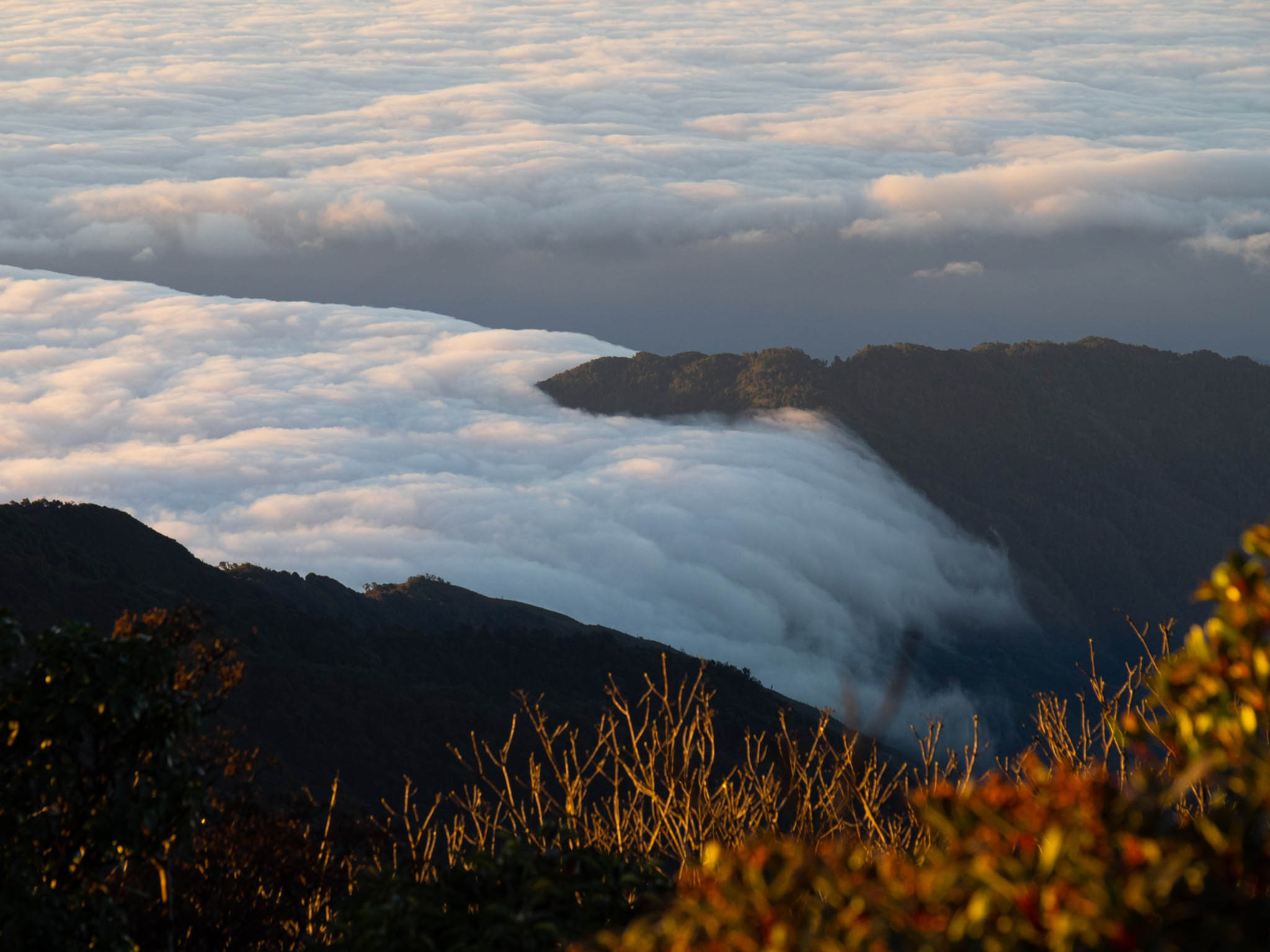
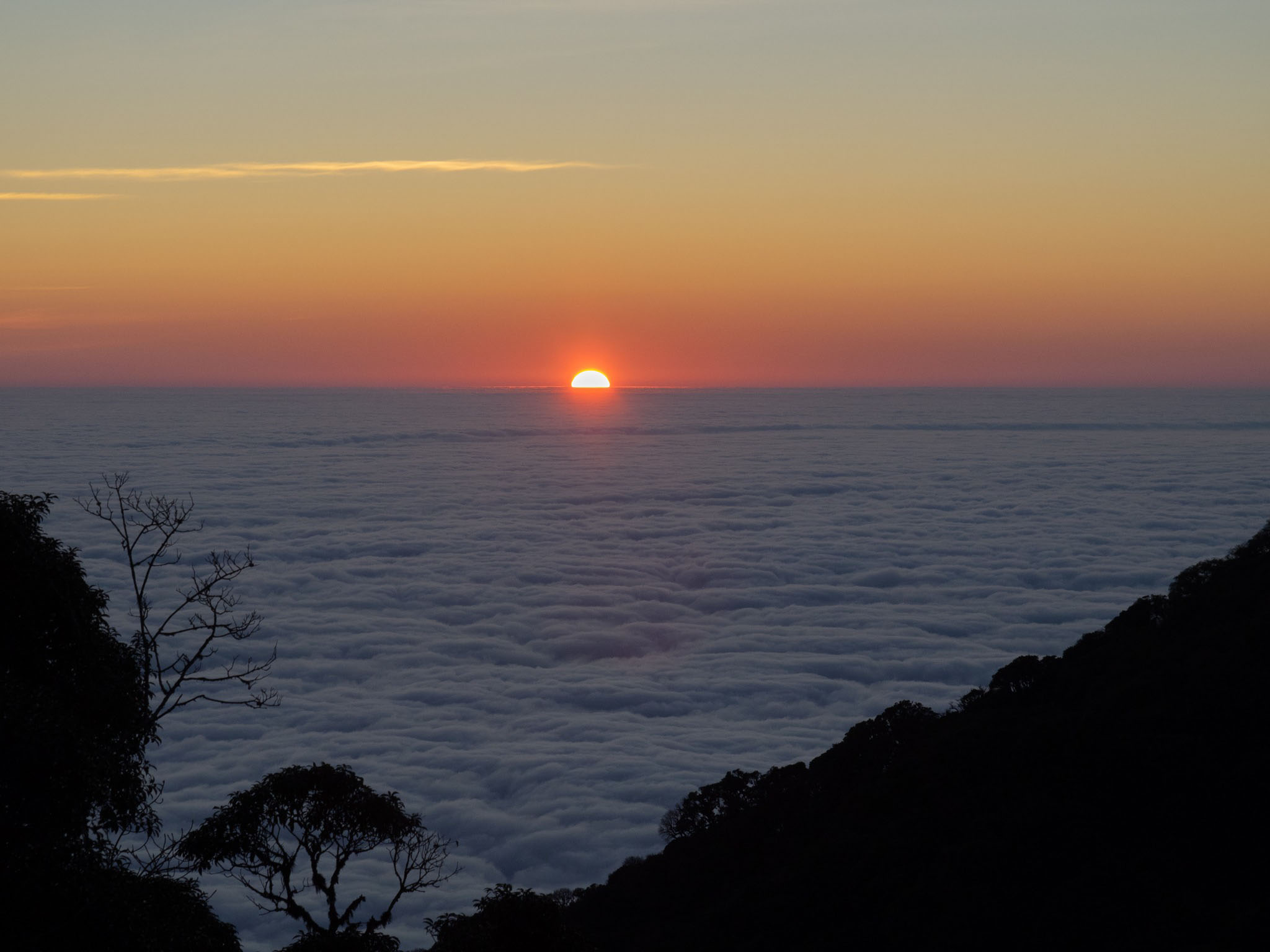
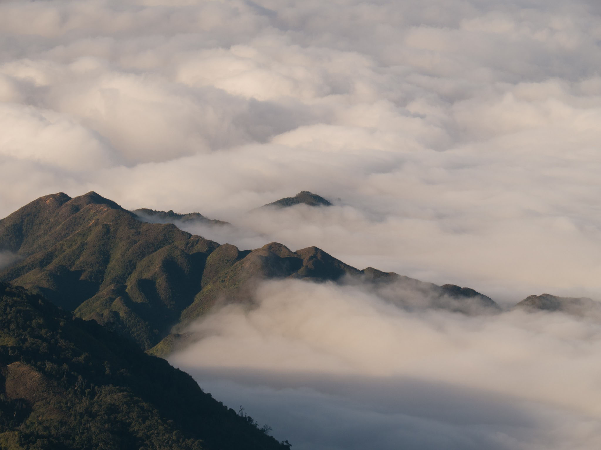
The floating "sea of clouds" seen from the top of Sa Mu. Photo: Do Van Tuyen
This mountain is quite strange to tourists. However, this place attracts visitors by its wild and interesting nature with unique vegetation.
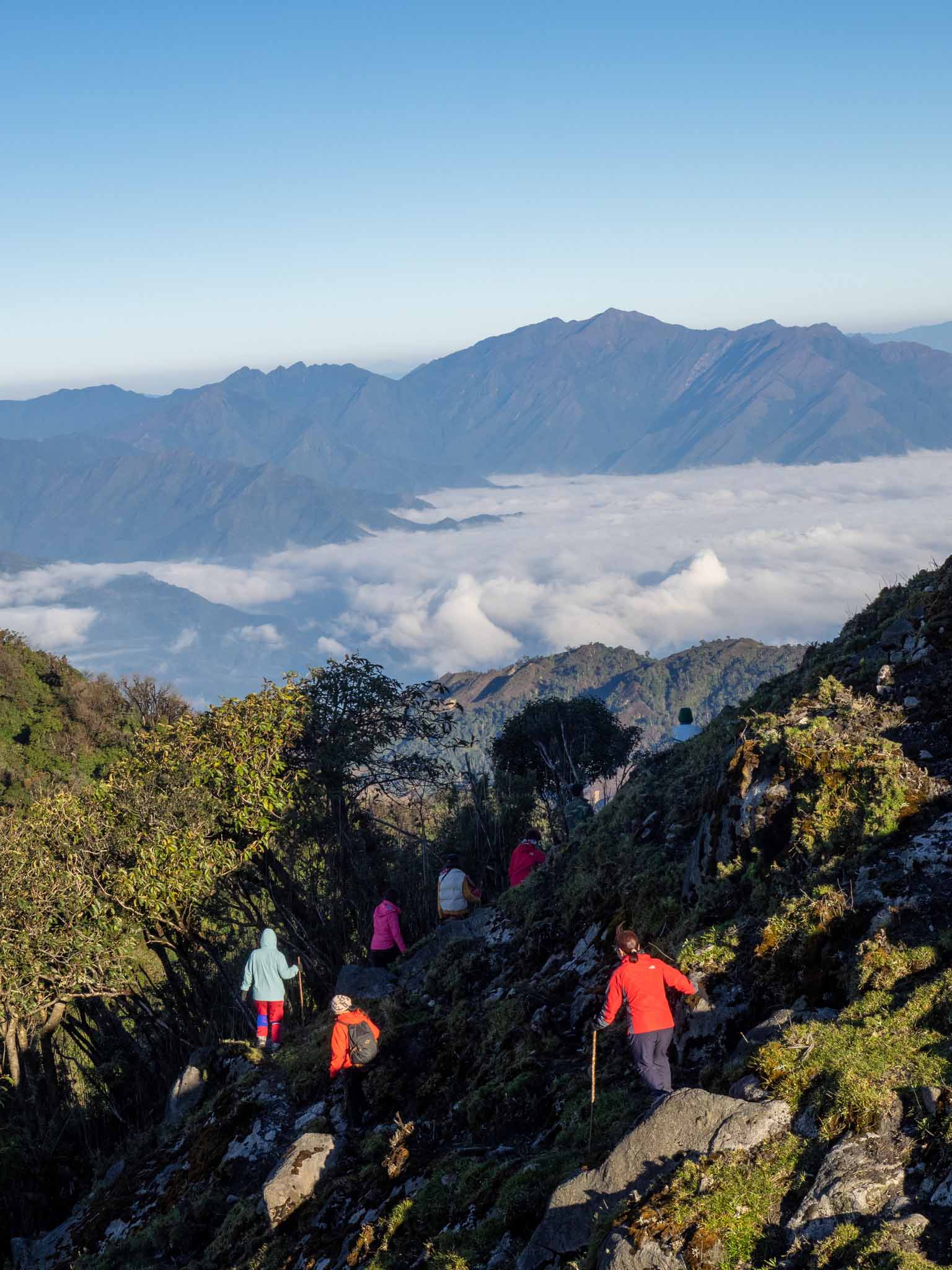
The road is quite difficult but makes up for the impressive scenery. Photo: Do Van Tuyen
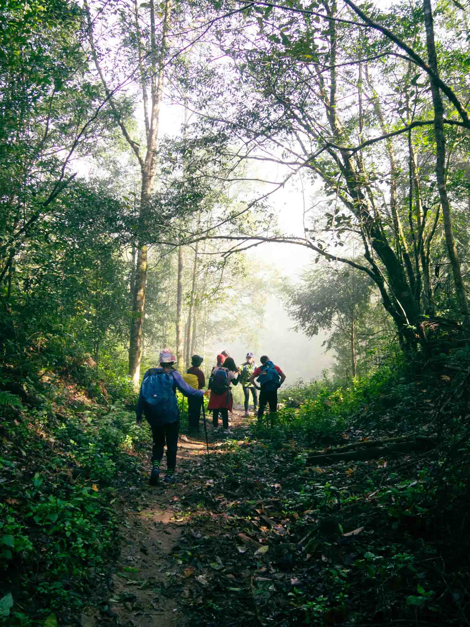
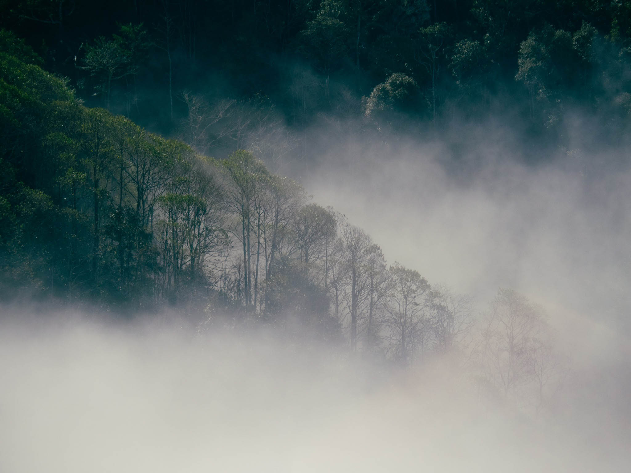
The trekking route through the primeval forest to conquer the top of Sa Mu. Photo: Do Van Tuyen
The Sa Mu peak trekking route will go through a primeval forest with the characteristics of a tropical rainforest, with a variety of plants such as moss, rhododendron, maple leaves, bamboo forest and many streams and waterfalls.
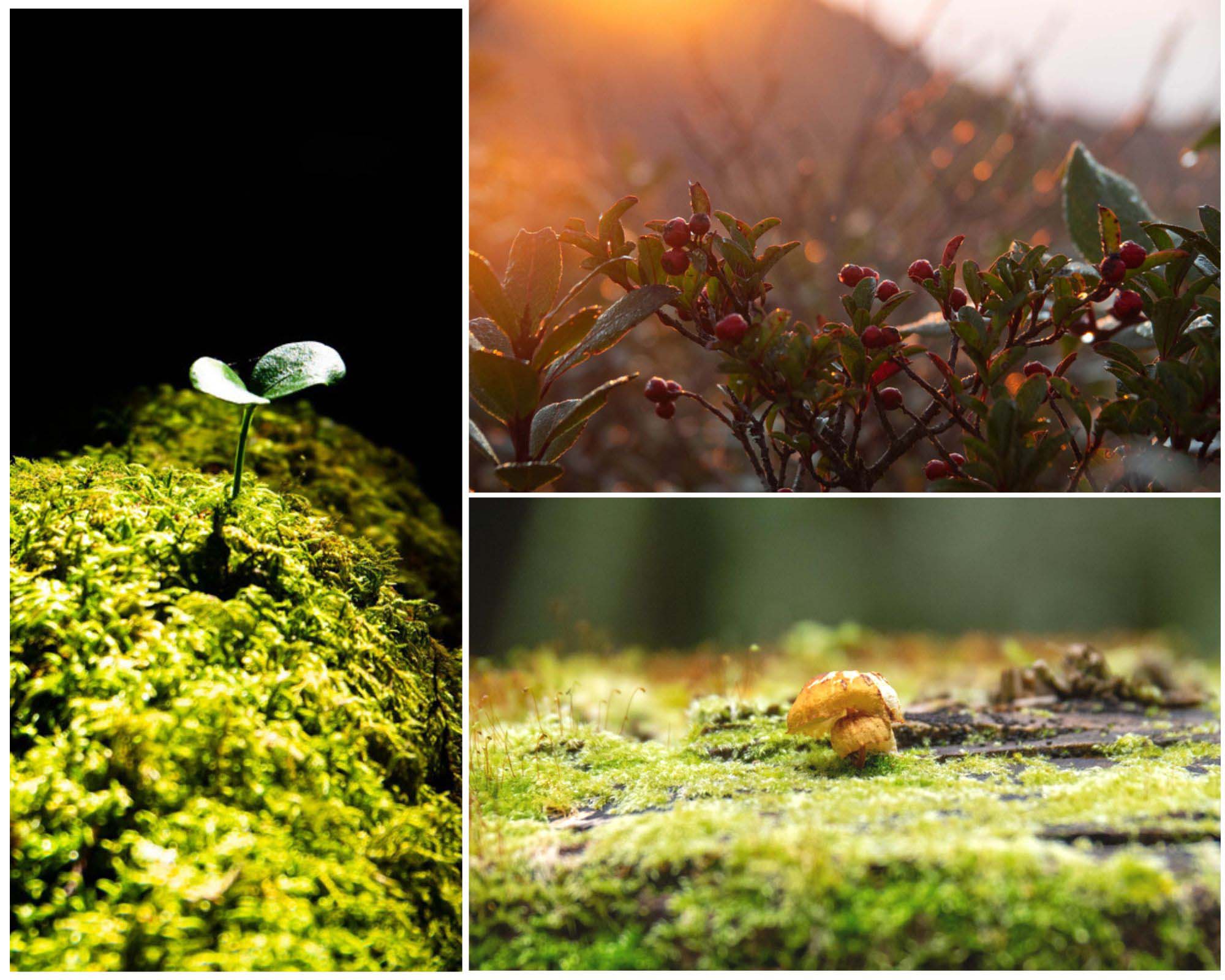
The vegetation here is divided into many layers with lots of color patches. Photo: Do Van Tuyen
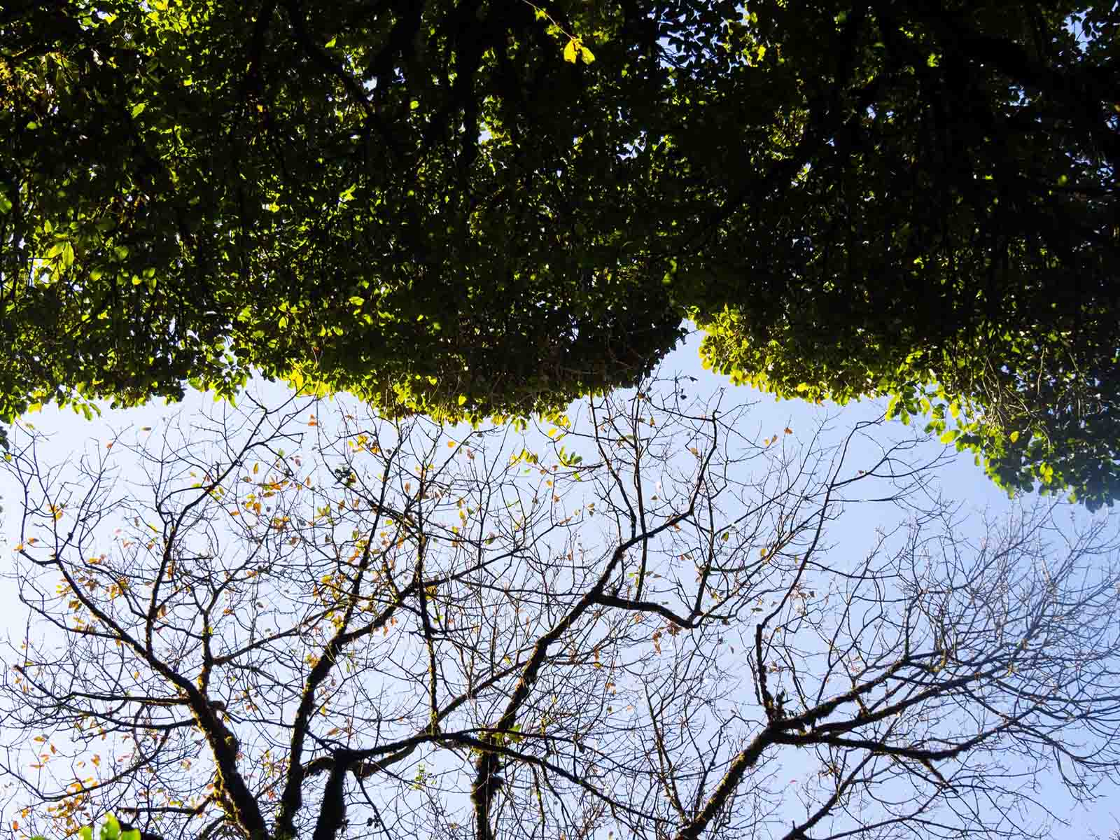
The higher you go, the more the forest on both sides of the road to Sa Mu exudes charm with moss carpets covering the path, soil, rocks and from the base to the top of the tree are covered with a dense layer of moss.
Carpet The vegetation in the forest varies with altitude and ridge direction. Photo: Do Van Tuyen
The vegetation here is divided into many layers with many color patches. The lower floor is covered with green, yellow, and gray moss, which is wide or narrow depending on the brightness of the sun. Where the forest leaves do not close the canopy, there is more sunlight, a layer of green ferns is spread.
Peak Sa Mu has an altitude of 2756m. Photo: Do Van Tuyen
In winter, the weather in the high mountains is quite harsh, the night temperature can drop to minus 2 degrees Celsius. Before coming here, tourists need to prepare thermal clothing and necessary personal items. equipment such as medicine, food, water and specialized climbing shoes.
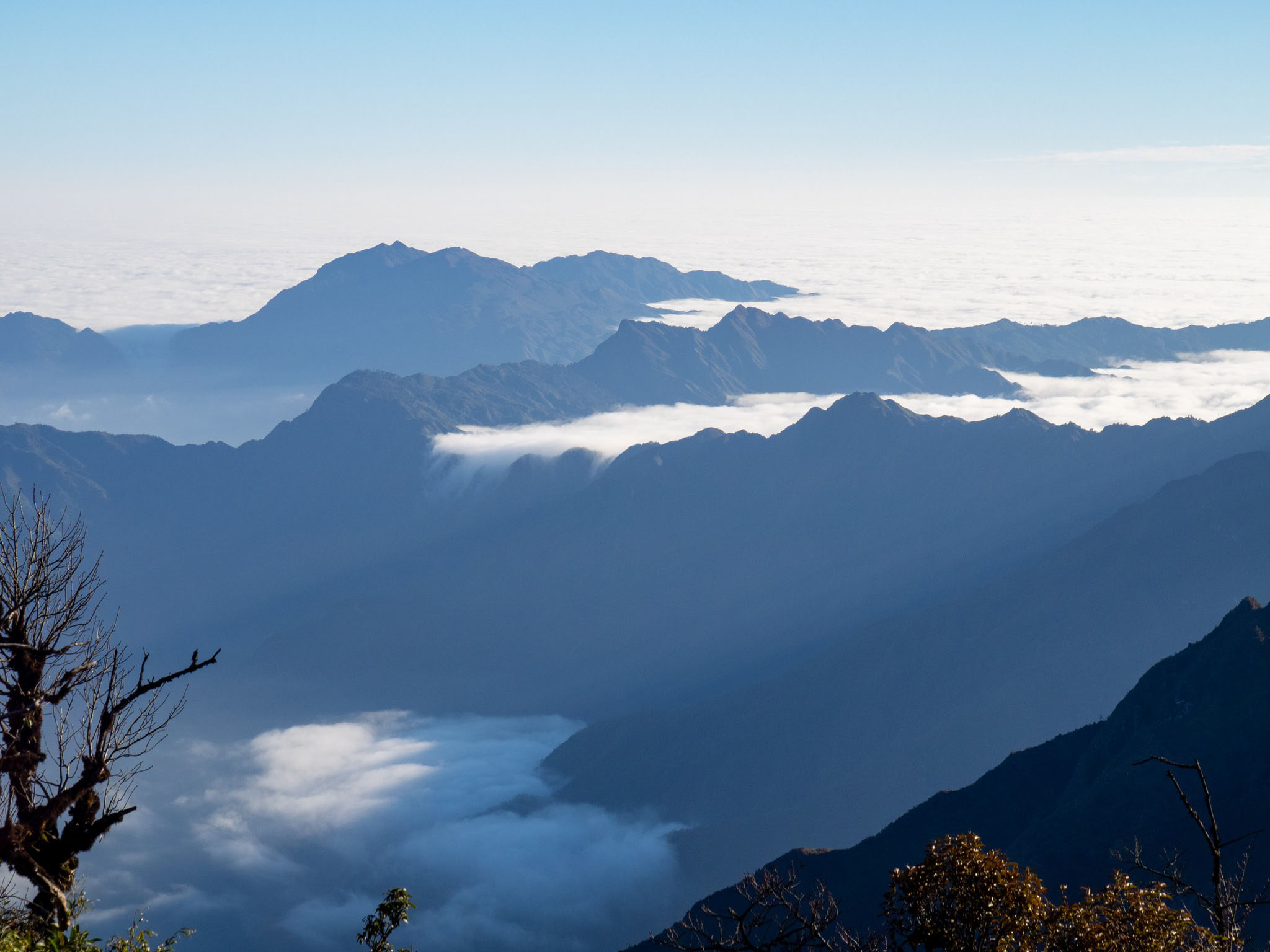
Besides Ta Xua, Sa Mu peak is also an ideal place to hunt clouds for tourists. Photo: Do Van Tuyen
Tourists can combine trekking and cloud hunting on the top of Sa Mu. From December to February is the easiest time to hunt for clouds on the top
The sea of clouds is rolling on all sides. Photo: Do Van Tuyen
Standing on top of Sa Mu looking down, the sea of clouds rolling on all sides, floating and wandering, making the whole area create a magical scene.
From December to February is an easy time to hunt. clouds at the top. Photo: Do Van Tuyen
On beautiful days, standing on top of Sa Mu can also see two famous peaks, Ta Xua and Ta Chi Nhu.
According to Son La newspaper, Ta Xua special-use forest is a stretch to the direction South of the Hoang Lien Son range and the boundary of the two provinces of Son La and Yen Bai, has an area of nearly 18,000ha and has many peaks over 2,000m along the mountain range with the highest peak about 2,800m in the Northwest.
Ta Xua special-use forest also has many unique habitats with high value for conservation of genetic resources, and is a place with good conditions for wild animals to grow and develop, bringing special conservation values. especially for the Northwest region and Vietnam in general. The magnificent natural scenery here is also a potential and advantage for economic development in the direction of tourism services, in order to increase incomes and improve people's lives.
The location of the top of Sa Mu - U Bo. Photo: Google Maps
Moc Chau Plateau is entering the most beautiful days of the year, when everywhere is the pure white color of plum blossoms. Coming to Moc Chau in the white plum blossom season when heaven and earth are in the moment of changing seasons, visitors will feel like they are lost in a fairyland because of the white color covering the hillsides and valleys.
The peak was just installed at the end of 2022, but Sa Mu peak has become a trekking coordinate that many travelers love to conquer and explore because of its beautiful scenery, magical primeval forest like a movie scene, and easy hunting. cloud.
With natural terrain and cool climate all year round, Moc Chau district (Son La) is favored by nature with majestic landscapes with famous natural tourist attractions and many types with their own identities that have created the attraction. Special guide for domestic and international tourists. In 2023, Moc Chau national tourist area for the second time was honored by the World Travel Awards as "Vietnam's Leading Natural Destination" and "Asia's Leading Regional Natural Destination 2023".
Sa Mu is known to everyone as a trekking resort in an ancient moss forest, the vegetation is still very pristine and magically beautiful. Tourists feel like they are lost in the movie Avatar
(SGTT) – About 200km from the center of Hanoi capital, Moc Chau is one of the attractive destinations in the North. If in the spring, this place attracts visitors from afar with peach blossoms, plum blossoms, apricot flowers... in the summer, the immense tea hills are the reason why tourists come here.
Winter - spring has really come to the beautiful Moc Chau plateau, the sunlight has begun to lighten, the weather is colder, signaling the beginning of a new flower season.
Moc Chau is known as the largest and most beautiful plateau in the Northwest region. This place stands out with the magnificent mountain landscape, winding roads hugging the mountainside, thick layers of fog that make the scenery strangely beautiful and enchanting. Not only that, right in the heart of Moc Chau plateau also appears a "treasure" that makes tourists come here, which is Dai Yem waterfall.
É Tong is a purely agricultural commune of Thuan Chau district, Son La province. Every year, the commune intensively cultivates nearly 100 hectares of rice. After bringing the water back, the Mong and Thai ethnic people took advantage of the land to cultivate. During the flood season, the fields here are as beautiful as a picture.
TPO - This year's New Year is adjacent to the weekend, people have a 3-day holiday continuously from December 30, 2023 to January 1, 2024. With such a short vacation, most tourists tend to choose short domestic and regional tours.
Nang Tien Waterfall located in Na Cha village, Chieng Khoa commune, Van Ho district (Son La) is like a strip of white clouds flowing from the top of the mountain down to the depths, creating a layer of mist as hazy as clouds. Perhaps that's why the name Thac May was born.
(PLO) - Spring is coming to Moc Chau plateau, Son La, children in Mong costumes carrying yellow mustard greens play in the blooming, white plum blossom forest, making tourists fascinated.
Coming to Moc Chau plateau (Son La) these days, visitors seem to be lost in a fairyland because of the pure white color of plum blossoms covering the valleys, mountains and hills, creating a pleasing picture.
Moc Chau is a land famous for its unique attractions, fresh, cool weather and colorful flower seasons. Plum blossom season is the time most sought after by tourists.

 vn
vn en
en ja
ja ko
ko zh
zh